Tropical Storm “Beta” moving slowly toward Texas, long-duration rainfall event from Texas to Louisiana
Tropical Storm "Beta" is slowly moving WNW toward Texas, producing a long-duration rainfall event from the middle Texas coast to southern Louisiana. There is the danger of life-threatening storm surge through Tuesday along portions of the Texas and Louisiana coasts. Beta is the 23rd named storm of the 2020 Atlantic hurricane season and the 10th so far this month — a record for September.
At 15:00 UTC on September 20, the center of Tropical Storm "Beta" was located about 290 km (180 miles) SE of Galveston and 360 km (225 miles) ESE of Port O'Connor, Texas.
Its maximum sustained winds were 95 km/h (60 mph) and minimum central pressure 996 hPa.
Beta was moving WNW toward Texas at 6 km/h (3 mph).
A Storm Surge Warning is in effect for Port Aransas, Texas to Rockefeller Wildlife Refuge, Louisiana, including Copano Bay, Aransas Bay, San Antonio Bay, Matagorda Bay, Galveston Bay, Sabine Lake, and Lake Calcasieu.
A Tropical Storm Warning is in effect for Port Aransas, Texas to Morgan City, Louisiana.
A Tropical Storm Watch is in effect for Baffin Bay to Port Aransas, Texas.
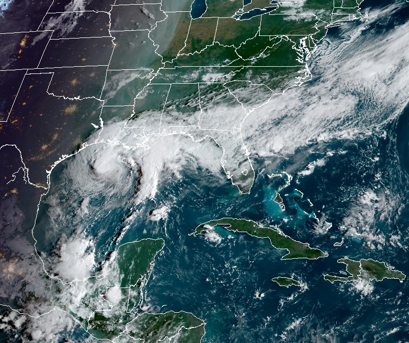
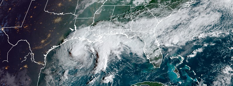
Tropical Storm "Beta" at 13:10 UTC on September 20, 2020. Credit: NOAA/GOES-16, RAMMB/CIRA
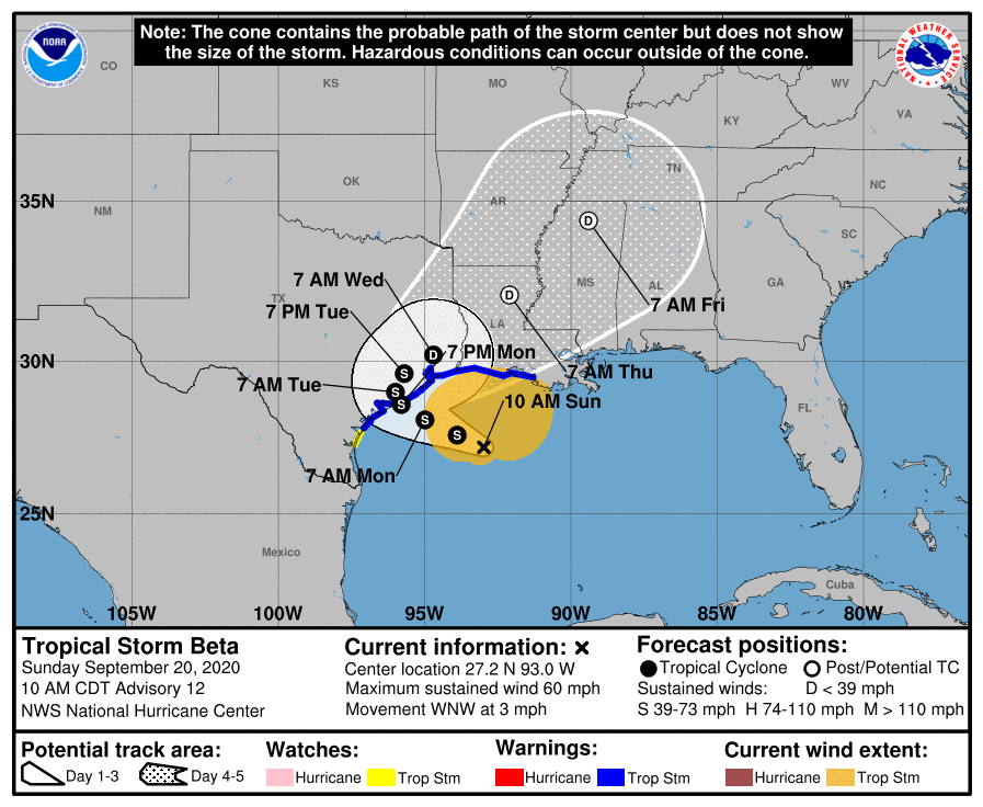
A slightly faster motion toward the WNW is forecast to occur during the next couple of days, followed by a slow down and a turn to the north and northeast Monday night and Tuesday.
NHC forecast track takes Beta toward the coast of Texas, with landfall expected Monday or Monday night, September 21. The storm is then expected to remain close to the coast of southeastern Texas on Tuesday.
The expected slow motion of Beta will produce a long duration rainfall event from the middle Texas coast to southern Louisiana. Flash, urban, and river flooding is likely.
Rainfall will then spread northward into the lower Mississippi River Valley by mid-week where flash, urban, and river flooding is possible.
The combination of a dangerous storm surge and the tide will cause normally dry areas near the coast to be flooded by rising waters moving inland from the shoreline.
The water could reach the following heights above ground somewhere in the indicated areas if the peak surge occurs at the time of high tide:
- Rockefeller Wildlife Refuge, LA to Ocean Springs, MS including Vermilion Bay, Lake Borgne, Lake Pontchartrain, and Lake Maurepas: 0.3 – 0.9 m (1 – 3 feet).
- Port Aransas, TX to Rockefeller Wildlife Refuge, LA including Copano Bay, Aransas Bay, San Antonio Bay, Matagorda Bay, Galveston Bay, Sabine Lake, and Calcasieu Lake: 0.6 – 1.2 m (2 – 4 feet).
- Baffin Bay, TX to Port Aransas, TX including Corpus Christi Bay and Baffin Bay: 0.3 – 0.9 m (1 – 3 feet).
- Mouth of the Rio Grande to Baffin Bay, TX: 0.3 – 0.6 m (1 – 2 feet).
"A mid-level ridge currently centered over the southwestern U.S. is forecast to slide eastward, which should cause Beta to move a little faster to the west-northwestward later today," NHC forecaster Cangialosi noted.
"This motion should continue for a couple of days, taking the storm to the Texas coast on Monday or Monday night. After Beta moves inland, the ridge is forecast to move away as a shortwave trough approaches from the west.
"This change in the pattern is expected to cause Beta to slow down, or even stall, on Tuesday and then turn northeastward after that."
Through Thursday, Beta is expected to produce rainfall accumulations of 200 – 300 mm (8 to 12 inches) with isolated totals of 500 mm (20 inches) from the middle Texas coast to southern Louisiana, with 100 to 200 mm (4 to 8 inches) spreading northward into the lower Mississippi River Valley by mid-week. Flash and urban flooding is likely, as well as minor to isolated moderate river flooding.
A tornado or two could occur Monday near the middle-to-upper Texas coast or the southwestern Louisiana coast.
Featured image: Tropical Storm "Beta" at 13:10 UTC on September 20, 2020. Credit: NOAA/GOES-16, RAMMB/CIRA
Commenting rules and guidelines
We value the thoughts and opinions of our readers and welcome healthy discussions on our website. In order to maintain a respectful and positive community, we ask that all commenters follow these rules:
We reserve the right to remove any comments that violate these rules. By commenting on our website, you agree to abide by these guidelines. Thank you for helping to create a positive and welcoming environment for all.