Strong and shallow M6.2 earthquake hits New Britain region, P.N.G.
A strong and shallow earthquake registered by the USGS as M6.2 hit the New Britain region of Papua New Guinea at 06:49 UTC (16:04 LT) on February 9, 2020. The agency is reporting a depth of 31 km (19 miles). EMSC is reporting M6.2 at a depth of 60 km (37 miles).
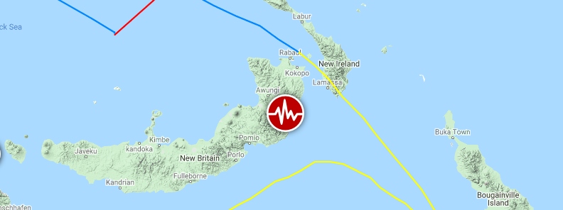
The epicenter was located 124.7 km (77.5 miles) S of Kokopo (population 26 237), and 217.5 km (135.2 miles) E of Kimbe (population 18 847), Papua New Guinea.
There are about 40 000 people living within 100 km (62 miles).
1 000 people are estimated to have felt strong shaking, 12 000 moderate and 232 000 light.
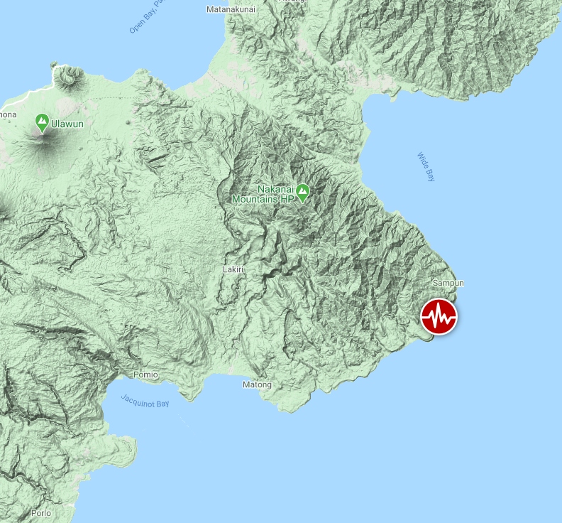
Image credit: Google, TW/SAM
The USGS issued a green alert for shaking-related fatalities and economic losses. There is a low likelihood of casualties and damage.
Overall, the population in this region resides in structures that are a mix of vulnerable and earthquake-resistant construction. The predominant vulnerable building types are informal (metal, timber, GI etc.) and unreinforced brick masonry construction.
Recent earthquakes in this area have caused secondary hazards such as landslides that might have contributed to losses.
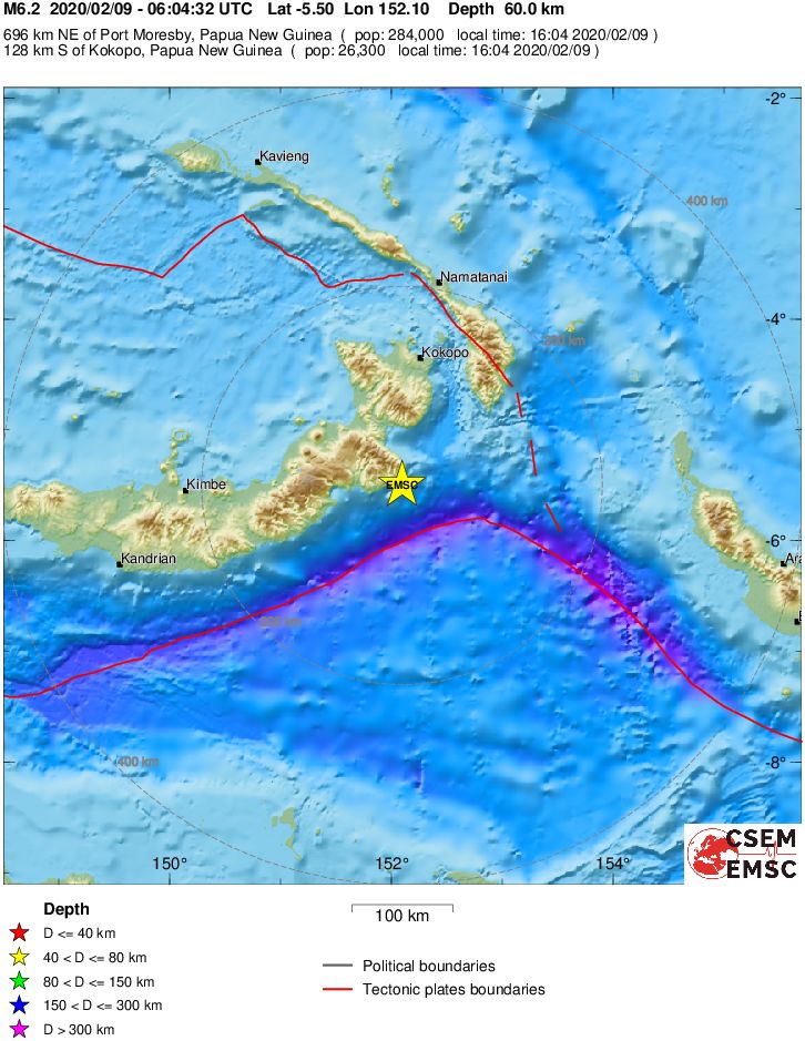
Regional seismicity

Featured image credit: Google, TW/SAM
Commenting rules and guidelines
We value the thoughts and opinions of our readers and welcome healthy discussions on our website. In order to maintain a respectful and positive community, we ask that all commenters follow these rules:
We reserve the right to remove any comments that violate these rules. By commenting on our website, you agree to abide by these guidelines. Thank you for helping to create a positive and welcoming environment for all.