Powerful blizzard, epic snowfall rates hit Newfoundland and Labrador, St. John’s declares a state emergency
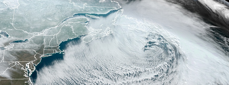
A rapidly intensifying winter storm brought intense blizzard conditions to parts of Newfoundland and Labrador, Canada on Friday, January 17, 2020, forcing St. John's authorities to issue a state of emergency.
Epic snowfall rates of more than 10 cm (3.9 inches) per hour were falling in St. John's at times through Friday morning, The Weather Network reports. By the lunch hour, over 30 cm (11.8 inches) was already on the ground in the city and there is plenty more to come.
Hurricane-force winds, in excess of 130 km/h (80 mph) are expected and 40 to 70+ cm (1.3 – 2.3 feet) of snow in some areas.
Higher than normal water levels along the east and northeast coasts due to 60 to 80 cm (1.9 – 2.6 feet) of storm surge combined with 9 to 12 m (0.9 – 39 feet) waves are expected from late this evening until early Saturday afternoon.
Flooding and damage to coastal infrastructure are possible, especially in locations exposed to the north. Highest water levels are expected near high tide tonight and again early Saturday afternoon.
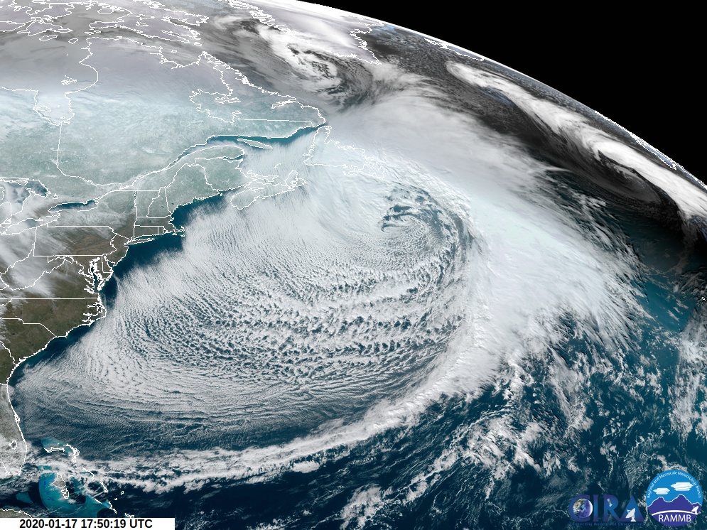
Image credit: NOAA/GOES-East. Acquired at 17:50 UTC on January 17, 2020
A storm surge and blizzard warnings are currently in effect for St. John's and vicinity.
Dangerous blizzard conditions are expected across the Avalon Peninsula, Clarenville and vicinity, and Bonavista Peninsula, with very strong winds and near-zero visibility in heavy and blowing snow.
The highest amounts of snow are expected over the northern Avalon and Bonavista Peninsulas until Saturday afternoon (LT, local time).
Conditions are expected to improve early on Saturday for most areas but strong winds and blowing snow will persist over coastal areas exposed to the north into Saturday afternoon.
Damage to buildings, such as roof shingles and windows, may occur. Store or anchor objects so they are not tossed by the wind causing injury or damage.
Power outages may also occur.
"Consider postponing non-essential travel until conditions improve. If you do travel and become lost, remain where you are until the blizzard has passed," Environment Canada warns.
High Storm Surge levels and large waves are expected to impact north-facing shorelines from Notre Dame Bay to Ferryland.
Maximum water levels are expected to significantly exceed high astronomical tide late this evening until early Saturday afternoon. First high tide after midnight (LT) tonight, and second early Saturday afternoon.
Flooding and damage to coastal infrastructure are possible, especially in locations exposed to the north. Highest water levels are expected near high tide tonight and again early Saturday afternoon.
At 11:00 LT (15:00 UTC) on January 17, the City of St. John’s has declared a state of emergency.
"Give the current and forecasted conditions, the state of emergency is in effect immediately and will remain in effect until lifted," St. John's authorities said.
"All businesses are ordered to close; shops closing regulations are suspended and all vehicles except emergency vehicles are prohibited from using City streets. City plowing operations will continue at this time. Please return home and do not drive until the state of emergency has been lifted."
Featured image credit: NOAA/GOES-East. Acquired at 17:50 UTC on January 17, 2020
Commenting rules and guidelines
We value the thoughts and opinions of our readers and welcome healthy discussions on our website. In order to maintain a respectful and positive community, we ask that all commenters follow these rules:
We reserve the right to remove any comments that violate these rules. By commenting on our website, you agree to abide by these guidelines. Thank you for helping to create a positive and welcoming environment for all.