Massive floods hit Cantabria, residents describe it as worst in history, Spain

Destructive flooding swept the town of Reinosa in Cantabria, Spain, on Thursday, December 19, 2019. The flood came after the Hijar river, which passes through Reinosa and its tributary Izarilla, rose significantly and burst their banks. Residents describe the event as the worst in history, with blackouts also reported amid heavy rain and winds.
Powerful river-like flood flowed through doors and garages, trapping at least 20 people in their homes and forcing other locals to evacuate.
Emergency services said they received hundreds of calls. The crew working in the area have examined whether any more evacuations of residents in the worst-hit establishments are needed.
The crew even asked residents to climb the highest levels of their homes as floods were expected to exceed the first story.
An advanced command post has been installed in Reinosa, with officials working all day to contain the flood.
Terribles imágenes que nos llegan desde Reinosa. Los vecinos con una gran impotencia ven como el agua arrasa con todo lo que se encuentra a su paso#Inundaciones #SOSCantabria pic.twitter.com/fx3Lst0QZn
— Cantabria24horas (@Cantabria24h) December 20, 2019
Reinosa se hunde. Qué horror…
#Inundaciones pic.twitter.com/TLqWdEFm60— Sergio Balbontín / (@BalbonReinosa) December 19, 2019
#Reinosa anegada. Zona catastrófica. #BorrascaElsa nos deja hundidos. Seamos fuertes, todos unidos y con la ayuda de todos saldremos de esta también. #Inundaciones #Campoo #Cantabria pic.twitter.com/QmYGFw4q6K
— Sergio Balbontín / (@BalbonReinosa) December 19, 2019
The tracks of the Renfe train line between Santander and Madrid were affected, leading authorities to cancel services.
Shocking videos were posted on social media, showing cars being washed away by roaring floodwater.
The older people of Reinosa said they don't remember ever seeing the water flooding the streets as it is happening since the night came to the capital of the region of Campoo, a town located more than 800 m (2 624 feet) above the river Ebro, Spain's News reported. The town is home to 9 000 people.

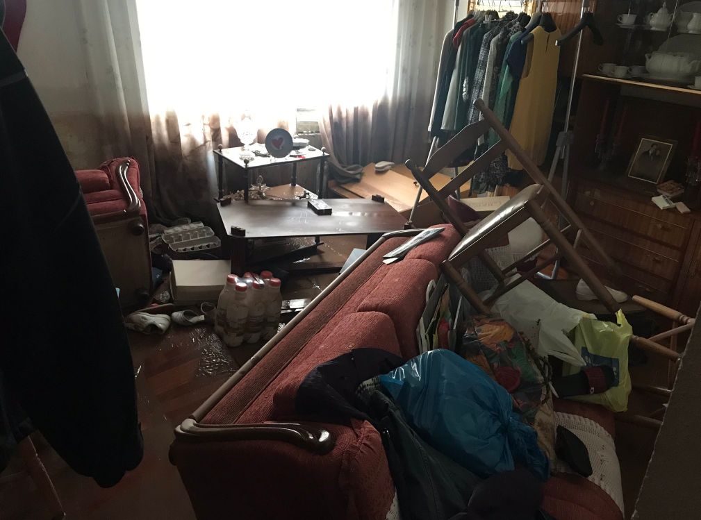
Image credit: @BalbonReinosa/Twitter
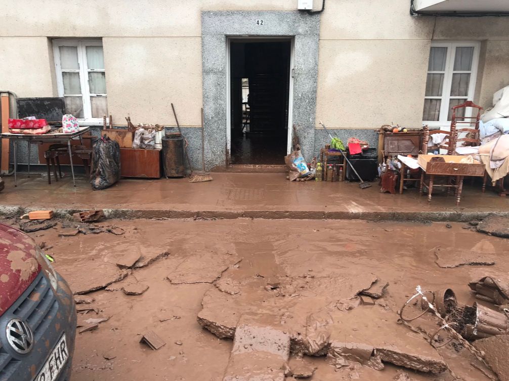
Image credit: @BalbonReinosa/Twitter
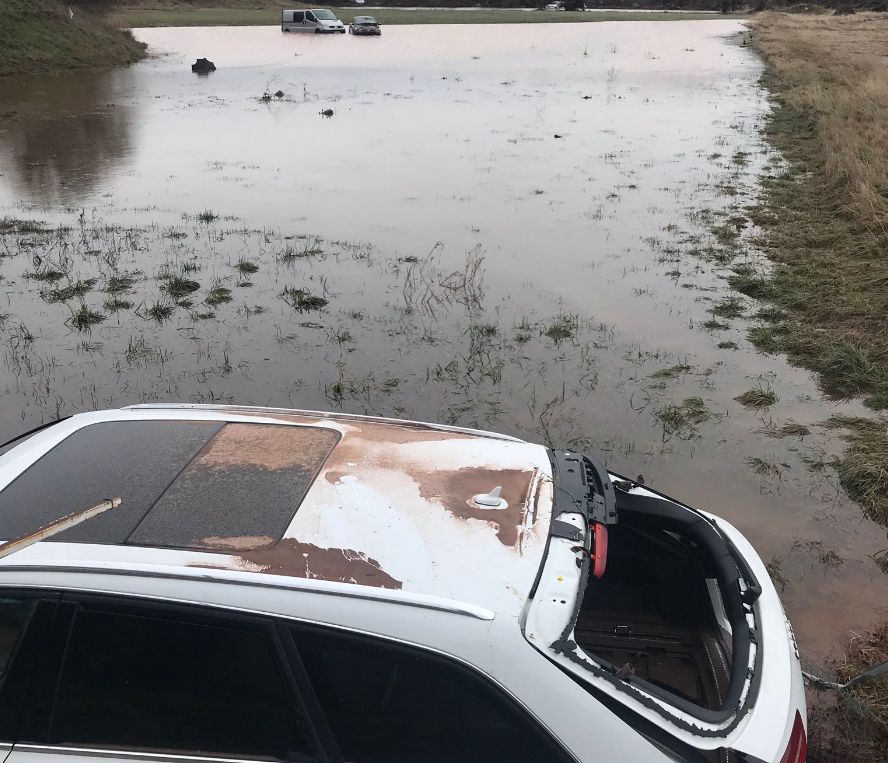
Image credit: @BalbonReinosa/Twitter
Featured image credit: cylTV
Check out Seattle as well. They have been getting clobbered by a big AR, and look at the length of the tail ending down close to Hawaii, … https://earth.nullschool.net/#current/wind/surface/level/overlay=total_cloud_water/orthographic=-128.04,36.41,672/loc=-129.443,42.984
This is what happens when warm gives way to cool. The excess water vapor which accumulated during the warm trend gets wrung out of the atmosphere when temps drop sufficiently. The ongoing deep solar minimum likely plays a role as well. Reminds me of the 1950s/60s.
Weather warfare & agenda 21/2030 going well.