Forecast models suggest rare formation of twin tropical cyclones in western Indian Ocean
Numerical forecast models suggest two tropical cyclones are about to form in the western Indian Ocean this week, churning face-to-face on both sides of the equator.
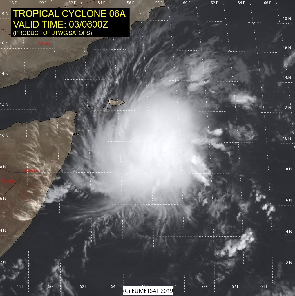
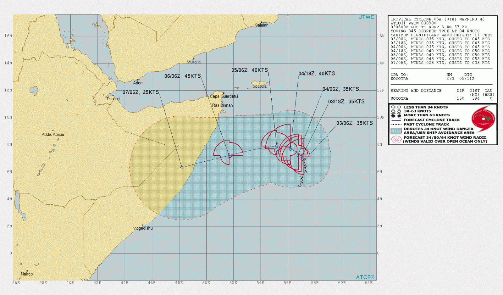
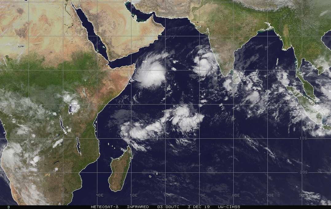
A deep depression formed over the southwest Arabian Sea on December 2, 0219, and concentrated into deep depression early December 3. The cyclone is currently designated Tropical Cyclone 06A (Six). It is expected to continue intensifying and receive the name Soba by 12:00 UTC today.
At 04:00 UTC today, 06A had maximum sustained winds of 65 km/h (40 mph) and gusts to 83 km/h (51 mph).
Its center is currently located about 660 km (372 miles) SSE of Socotra, Yemen (about 350 km / 215 miles E of Somalia) and 900 km (560 miles) ESE of Bosaso, Somalia.
The cyclone is expected to move NNE for some time and then recurve WSW toward Somalia over the next 4 days. Landfall is expected on December 6.
The second cyclone is still a tropical disturbance, currently designated Invest 91S and located over Seychelles at 04:00 UTC, approximately 1 553 km (965 miles) north of Mauritius.
"Animated multispectral satellite imagery reveals a partially exposed low level circulation with a band of convention extending northeastward," JTWC forecasters noted.
The upper level environment is favorable for development with low vertical wind shear and moderate poleward outflow while sea surface temperatures remain favorable for intensification.
Global models are in good agreement that 91S will slowly intensify as it tracks slowly SSW. Its current minimum sea level pressure is estimated near 1 006 hPa.
The potential for the development of significant tropical cyclone within the next 24 hours is medium.
This system may potentially impact Madagascar on December 8, bringing very strong winds and heavy rain. Note that this is still 5 days ahead — the cyclone could take a different track.
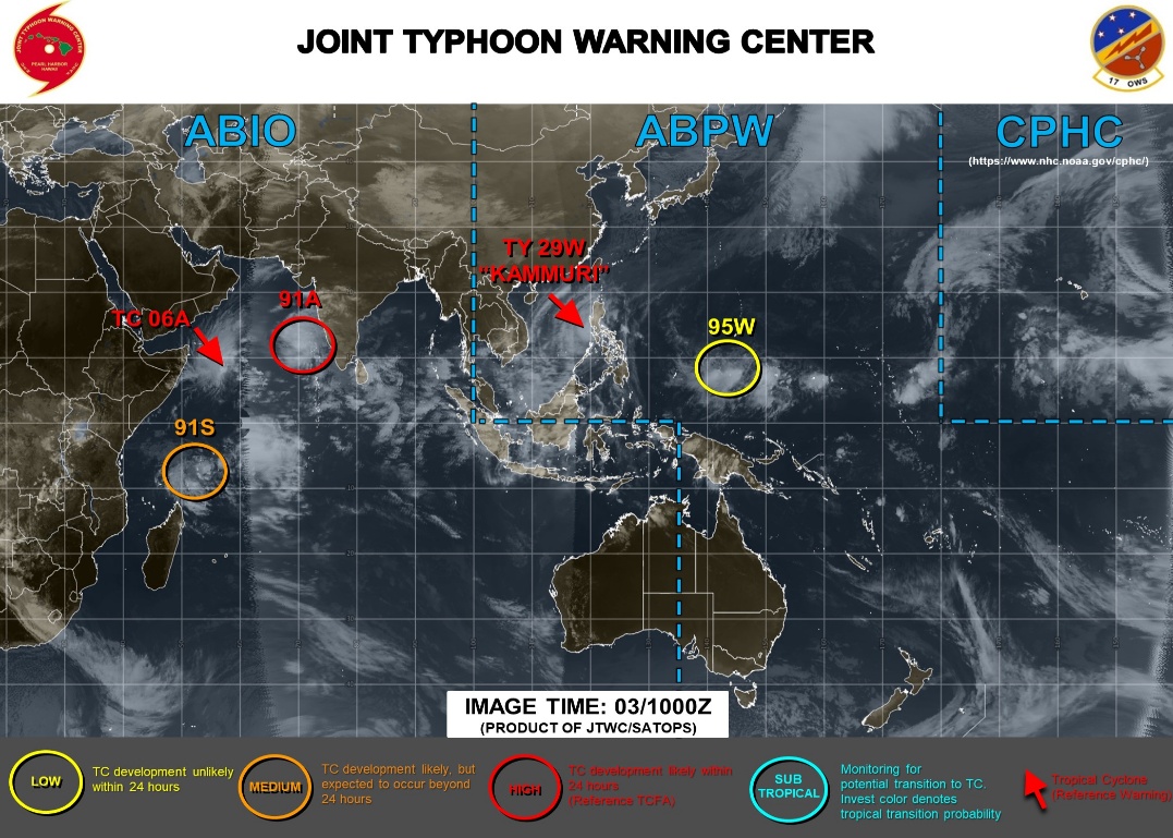
"This is a rather rare situation, as twin tropical cyclones will spin up, on a similar longitudinal line (55°E), but on opposite sides of the equator," Severe Weather Europe meteorologists said.
"This is not something we can witness every year or even every few years."
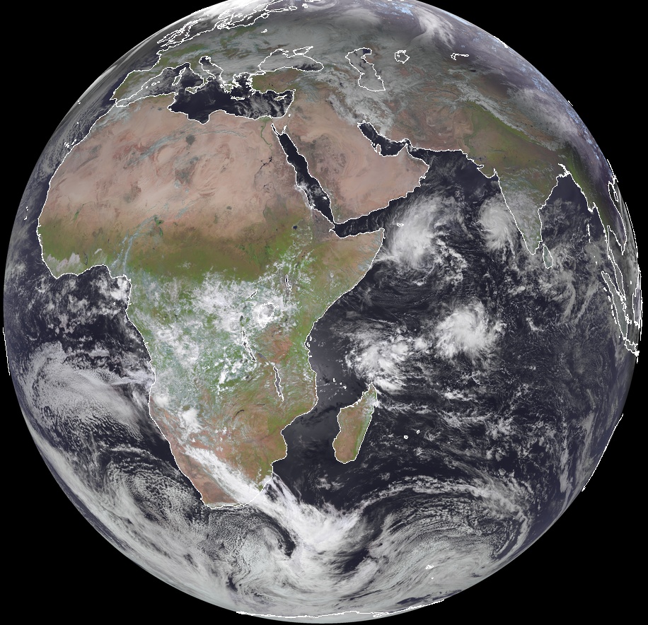
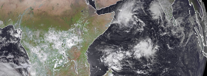
Image credit: Meteosat. Acquired 09:45 UTC on December 3, 2019
Forecast models
Featured image credit: Meteosat. Acquired 09:45 UTC on December 3, 2019
Looks to me like there are 4 potential storms. … https://earth.nullschool.net/#current/wind/surface/level/orthographic=-294.12,2.37,1107