Major winter storm affecting the United States on a busy holiday weekend, ice storm warnings in effect
A major winter storm that hammered the western United States and northern Plains with heavy snow and strong winds over the past couple of days has now reached the Great Lakes region. In South Dakota, 9 people were killed after a plane crashed due to severe weather on November 30, 2019. In Arizona, two children died while another is still missing after floods carried them away on November 29. Heavy rain and snow hit parts of California, leaving more than 17 000 without power.
This multi-faceted, trans-continental storm is producing a variety of impactful weather conditions on a busy Thanksgiving holiday travel weekend, ranging from blizzard conditions over parts of the Upper Midwest to strong thunderstorms across the Southeast U.S., NWS forecaster David Hamrick noted early Sunday, December 1.
Heavy snow can be expected from the eastern Dakotas to northern Michigan on Sunday, with potential snowfall accumulations on the order of 15 – 30 cm (6 to 12 inches).
"By late Sunday, secondary cyclogenesis occurs off the southern New England coast and becomes the dominant low pressure center through early in the week," Hamrick said.
"This will evolve into more of a typical nor'easter type system with rain and wind near the coast, and heavy snow inland. The potential exists for 20 to 40 cm (8 to 16 inches) of snow across interior portions of New York and extending eastward to southern Maine, with winter storm warnings in effect.
"Farther to the south across the central Appalachians, freezing rain will be more of a problem with the potential of up to 6 mm (0.25 inches) of ice accretion from extreme western Maryland to central Pennsylvania where ice storm warnings are in effect. Severe travel disruptions are likely for many of these areas."

Nine fatalities were reported after an Idaho-bound Pilatus PC-12 crashed shortly after takeoff in South Dakota on Saturday afternoon. Among those killed were the pilot and two children, according to the state's attorney for Brule County Theresa Maule Rossow. Meanwhile, three survivors were sent to a medical facility in Sioux Falls.
The cause of the crash has not yet been determined, but Maule Rossow said the weather conditions included "strong winds and snow" during the time of the crash. FAA investigators have traveled to the site. The National Transportation Safety Board will also manage the investigation.
Many parts of Arizona were hit with strong winds and floods across the Thanksgiving holiday week. On Friday morning, three children went missing after floodwater swept their vehicle. On Saturday, the Gila County Sheriff's Office said two of the victims have been found dead, while the search continues for the third missing child.
Several agencies including the Tonto Basin, TriCity, and Global Fire Departments lend their helping hand in the search.
The sheriff's office warned residents that some roads and bridges were closed due to unsafe conditions.

An atmospheric river brought record rainfall to parts of Los Angeles, California, and heavy snow to state's mountains and high deserts over the past couple of days.
Around 1 200 mm (47 inches) of snow was recorded at the Big Bear Mountain Resort on its opening day, November 29. "This is pretty unreal, especially for Southern California," said Justin Kanton, Big Bear Mountain Resort spokesman.

Palmdale registered 100 mm (4 inches) of snow, making the plowing process very challenging for the city without many plows, The Los Angeles Times reports.
"This amount of accumulation is not routine for us," Palmdale Mayor Steve Hofbauer said. "But we’ve got a lot of other road maintenance equipment that can be pressed into use, so pretty much anything with a shovel on it kind of became the defacto snowplows, and the guys did a great job."
More Rain on the way. Here's your radar update at 6 AM. #cawx pic.twitter.com/gkqvpVKvcf
— NWS Bay Area (@NWSBayArea) December 1, 2019
Two major storm systems are likely to cause travel disruptions even further across portions of the US heading into Sunday, December 1, according to National Weather Service (NWS) meteorologist Lara Pagano.
"We're seeing travel impacts for the Upper Midwest into the Great Lakes, and then that's going to transition into portions of the Northeast for wintry precipitation as we get through the remainder of Sunday, Sunday night and then getting into Monday as well," she stated.
Traveling north and west of Sioux Falls today? That may not be very easy, or even possible in some cases. A major winter storm will continue to take shape today and come to an end through the day on Sunday. pic.twitter.com/upbfUO7xAj
— NWS Sioux Falls (@NWSSiouxFalls) November 30, 2019
Swaths of the Northern Plains into Minnesota, Michigan, and Wisconsin could see snowfall of 152 to 305 mm (6 to 12 inches), while some areas will see as much as 457 mm (20 inches), NWS said.
As the storm moves east, travel into and out of East Coast areas such as New York, Connecticut, and Massachusetts on December 1 evening may be impacted.
Wintry weather will produce some difficult travel conditions across parts of the Eastern US Sunday & Monday. The big storm that moved onto the west Coast last Tue will reach the Eastern US this weekend, redeveloping off the Delmarva coast Sun evening & moving northeast on Monday. pic.twitter.com/TqhkWvBNSu
— NWS Eastern Region (@NWSEastern) November 29, 2019
The second system is bearing down on the West Coast, also likely to make travel difficult. "It's just this plume of moisture that's moving into, around San Francisco Bay region and the coastal region, and it's really helping to squeeze out a lot of that precipitation," Pagano said.
NWS Sacramento warned that travel is "highly discouraged" until Monday evening, December 2. The Sierra Nevada may see up to 610 mm (24 inches) of snow at elevations over 1 829 m (6 000 feet), with even higher snowfall at the highest elevations.
Snow forecast for I-80 & HWY 50. Heaviest snow amounts expected Saturday evening into Sunday. Up to 2-3 feet of snow are possible at pass levels. Snow decreases Monday night, with lighter snow accumulations continuing into Tuesday. Avoid travel by Saturday afternoon! #cawx pic.twitter.com/adotwjm2sf
— NWS Sacramento (@NWSSacramento) November 29, 2019
Across parts of the northeastern US, a dangerous ice storm will occur on Sunday, December 1– a busy travel period as the Thanksgiving holiday ends.
"A shallow layer of cold air and cold ground will create conditions that will allow a building up of ice, mainly in the form of freezing rain in some locations," said AccuWeather.
A dangerous ice storm is in the making across part of the northeastern United States and will occur during a busy travel period for the tail end of the Thanksgiving holiday weekend: https://t.co/qlex348ZfV pic.twitter.com/YLsOiiVLuE
— AccuWeather (@breakingweather) December 1, 2019
The ice storm may start off as snow and sleet in some locations, "while either of the two can allow for some traction by foot or vehicle, several hours of freezing rain will lead to a dangerous and, in some cases, [a] damaging glaze of ice," AccuWeather added.
Freezing rain has already begun Saturday night, November 30, across parts of northeastern West Virginia and western Maryland, western and central Pennsylvania, western New York state, and part of southern Ontario.
As of early Sunday, ice had accrued on surfaces in Somerset, Pennsylvania. Elevated areas in State College and Upper Strasburg has also been coated in ice.
Icy road conditions also caused several accidents in different areas across the country.


AccuWeather senior meteorologist Rob Miller said the worst of the ice build-up ranging from 6 to 13 mm (0.25 to 0.50 inches) of freezing rain is possible over south-central and central Pennsylvania and western Maryland.
"A glaze of ice of this magnitude is likely to bring down trees and power lines, which can block roads and knock out power for several days in some locations," he continued.
Other areas where up to 6 mm (0.25 inches) of freezing rain include east-central Pennsylvania, northern New Jersey, southeastern New York state, central and northern Connecticut, and interior Rhode Island.
"The ice storm will shift out of Pennsylvania and central New York state to part of interior southern New England during Sunday night," said AccuWeather. "Both storms with their atmospheric rivers that pull tropical moisture northward are likely to produce a firehose effect with a zone of heavy rain and heavy mountain snow."
Travel conditions are expected to improve on Tuesday, December 2. Snow is likely to begin in eastern New England in the same period.
A storm system hugging the Atlantic Coast early week will continue to drop heavy snow across portions of the Northeast on Monday. Some areas will see over a foot of snow before the storm moves out by Tuesday: https://t.co/M6ctIl3HXb pic.twitter.com/QrqsESJCLF
— AccuWeather (@breakingweather) December 1, 2019
An expansive storm system bringing rain, snow and ice across the Great Lakes and Northeast will make its presence known across the Southeast early week: https://t.co/vpindKaOdM pic.twitter.com/Byp8N26g21
— AccuWeather (@breakingweather) December 1, 2019
A storm currently moving in the Pacific Ocean that is loaded with moisture will slam into California during the first few days of December and drop inches of rain, as well as yards of snow in the Sierra Nevada mountains: https://t.co/7GwbDWrDeM pic.twitter.com/Bq4dSeN91D
— AccuWeather (@breakingweather) December 1, 2019
Ice in Berthold. Photo by Heather Sue. #NDwx pic.twitter.com/qXz6XEVMRR
— Amber Wheeler (@AmberWheelerWX) December 1, 2019
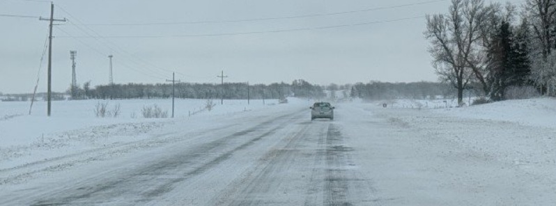
Featured image: Ice on roads of Iowa. Credit: Dickson County, Iowa Emergency Management
Reporting snow amounts and snow depth in mm in confusing and can easily be mistaken with liquid precipitation equivalent. Please round the figure and report snow in cm instead.