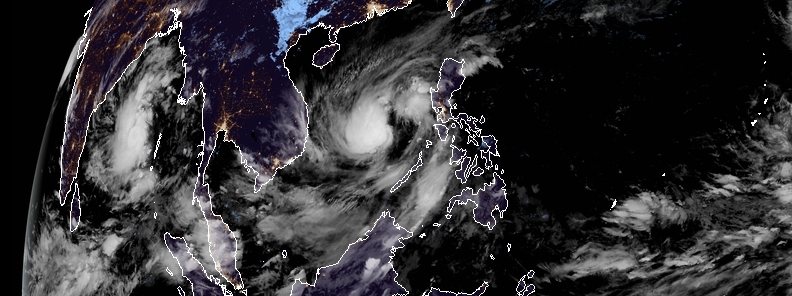
Tropical Storm “Nakri” (Quiel) almost stationary between Vietnam and Philippines
Tropical Storm "Nakri" – known as "Quiel" in the Philippines, is almost stationary over the West Philippine Sea and is expected to remain there for one more day, according to the Philippine Atmospheric, Geophysical, and Astronomical Services Administration's (PAGASA) Severe Weather Bulletin issued at 11:00 LT on November 6, 2019. The storm has maximum sustained winds of 75 km/h (47 mph) near the center and gusts up to 90 km/h (56 mph).
Nakri and the tail-end of a cold front are forecast to bring light to moderate with occasional heavy rains over the Babuyan Islands, Pangasinan, Zambales, Bataan, Occidental Mindoro, Antique, and some parts of Palawan, particularly Cuyo Islands and Kalayaan Islands.
Light to moderate with intermittent heavy rains will be seen over Batanes, Apayao, Ilocos Norte, Aklan, Iloilo, Oriental Mindoro, and the rest of Cagayan and Palawan, including Calamian Islands.
Residents of the said areas, especially those living in areas considered to be highly vulnerable to floods and rain-triggered landslides are urged to take precautionary measures and coordinate with local disaster risk reduction and management offices. Locals are also advised to stay tuned for updates, particularly the thunderstorm or rainfall advisories and heavy rainfall warnings to be issued bg PAGASA Regional Services Divisions.
PAGASA added that travel by sea could be risky, especially for small sea vessels over the northern and western seabords of Luzon as there could be rough seas.
Nakri is expected to intensify into a Severe Tropical Storm within 24 hours but remains less likely to make landfall in any part of the Philippines.
As of 17:00 LT on November 6, the center was located over the western part of the West Philippine Sea (near 13.3°N 116.4°E), about 433 km (269 miles) West Northwest of Coron, Palawan, or 522 km (324 miles) West Southwest of Metro Manila.
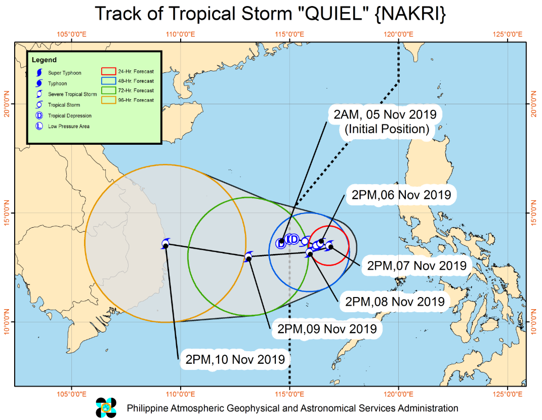
Image credit: PAGASA
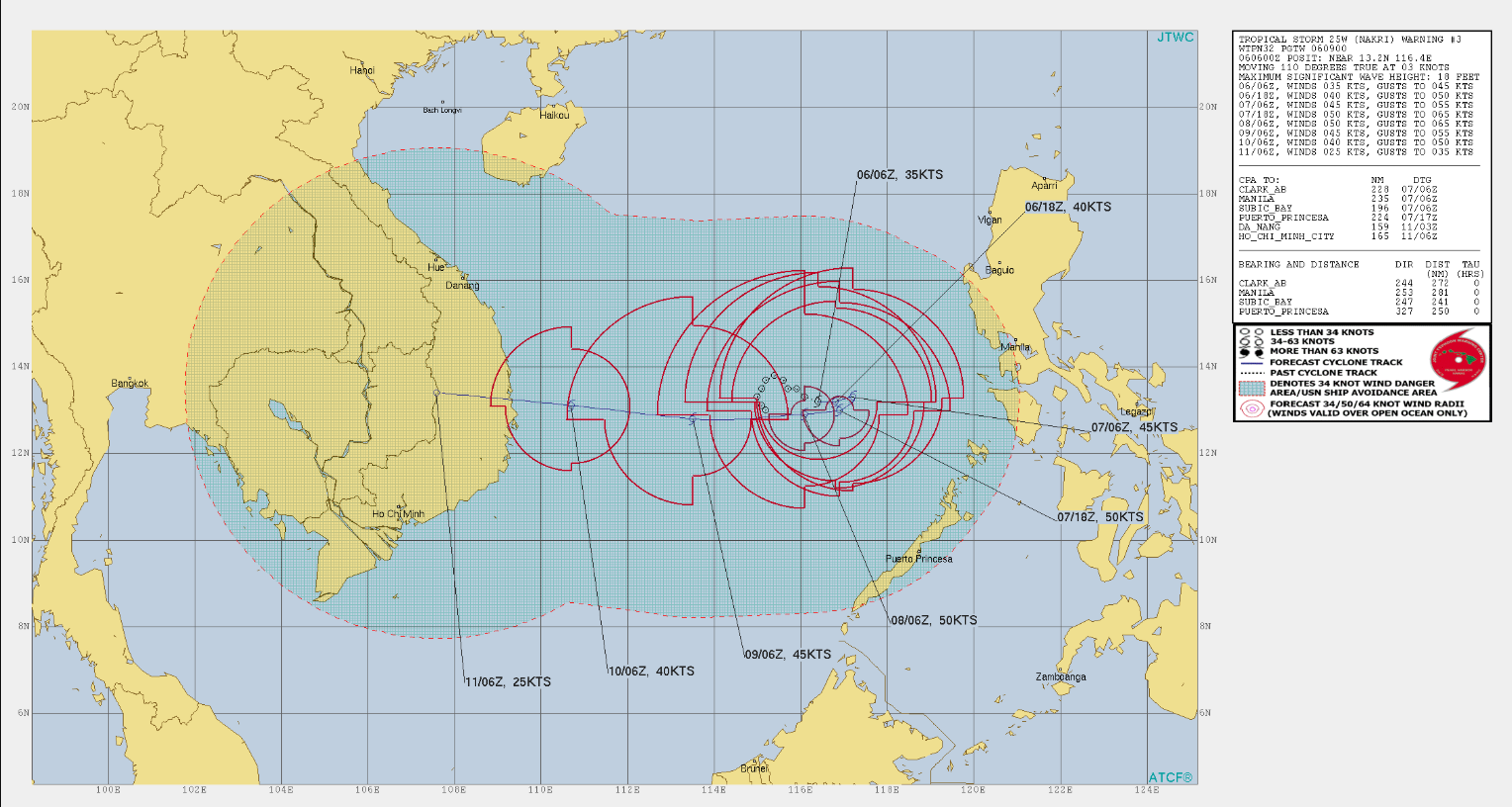
Image credit: Joint Typhoon Warning Center (JTWC)
According to forecasts, the storm will be drifting slowly eastward over the next 24 hours across the open waters of the West Philippine Sea as it intensifies further, 430 km (267 miles) West Northwest of Coron (13.4°N, 116.5°E).
By Friday morning, Nakri will be 505 km (314 miles) West Northwest of Coron (13.1°N, 115.7°E). In the afternoon, it will recurve to the West to WSW towards the South China Sea.
The storm will be outside the Philippine Area of Responsibility (PAR) by Saturday morning, November 9 as it maintains its Westward track and weakens to a tropical storm at 785 km (488 miles) West of Coron (13.2°N, 113.1°E).
No Tropical Cyclone Wind Signal has been issued.
The current forecast track takes Nakri toward Vietnam on November 10, bringing more rounds of very heavy rainfall.
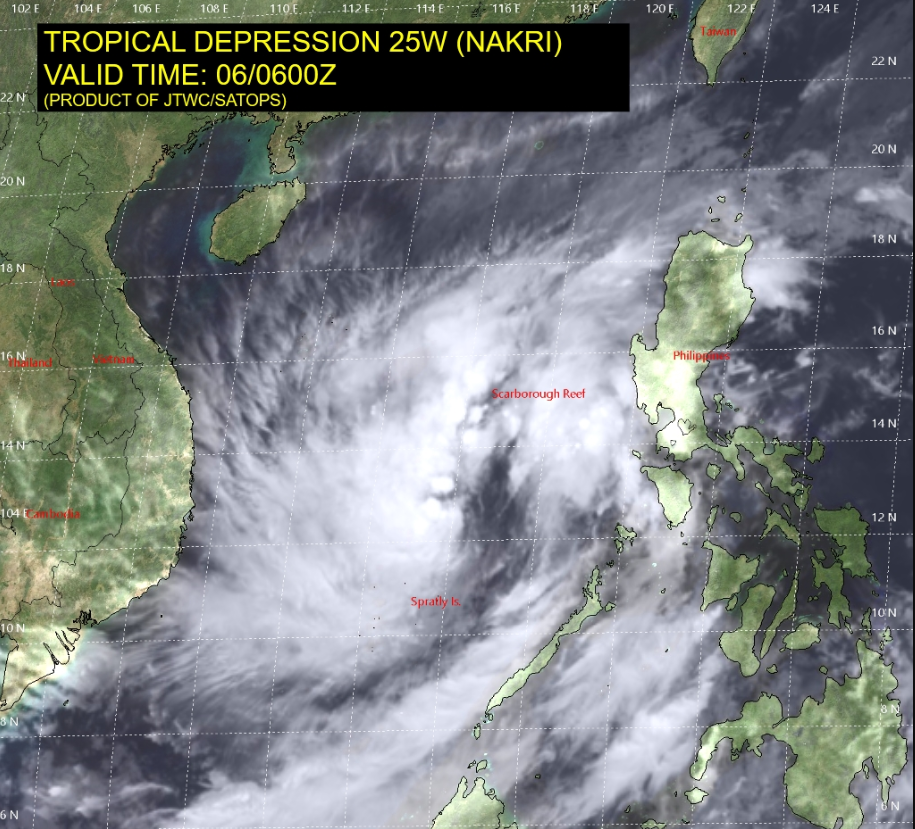
Image credit: Joint Typhoon Warning Center (JTWC)
Featured image credit: JMA/Himawari-8, RAMMB/CIRA
Commenting rules and guidelines
We value the thoughts and opinions of our readers and welcome healthy discussions on our website. In order to maintain a respectful and positive community, we ask that all commenters follow these rules:
We reserve the right to remove any comments that violate these rules. By commenting on our website, you agree to abide by these guidelines. Thank you for helping to create a positive and welcoming environment for all.