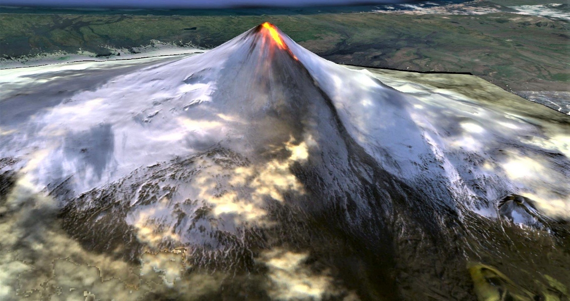
Eruption at Shishaldin continues, lava flowing beyond the summit crater, Alaska
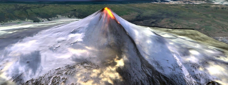
Low-level eruptive activity continues at Shishaldin Volcano. Two stalled lava flows extend beyond the summit crater up to 1.8 km (1.1 miles) down the northwest flank, and satellite data show trace ash deposits on the north flank and a lahar extending at least 4 km (2.5 miles) northwest from the summit by Monday, October 28.
Activity paused on Tuesday, October 29, with little seismicity and no evidence of lava flowing beyond the crater rim, but resumed on October 31. Numerous small explosions detected on the local network and incandescence visible in overnight webcam images indicate renewed summit activity.
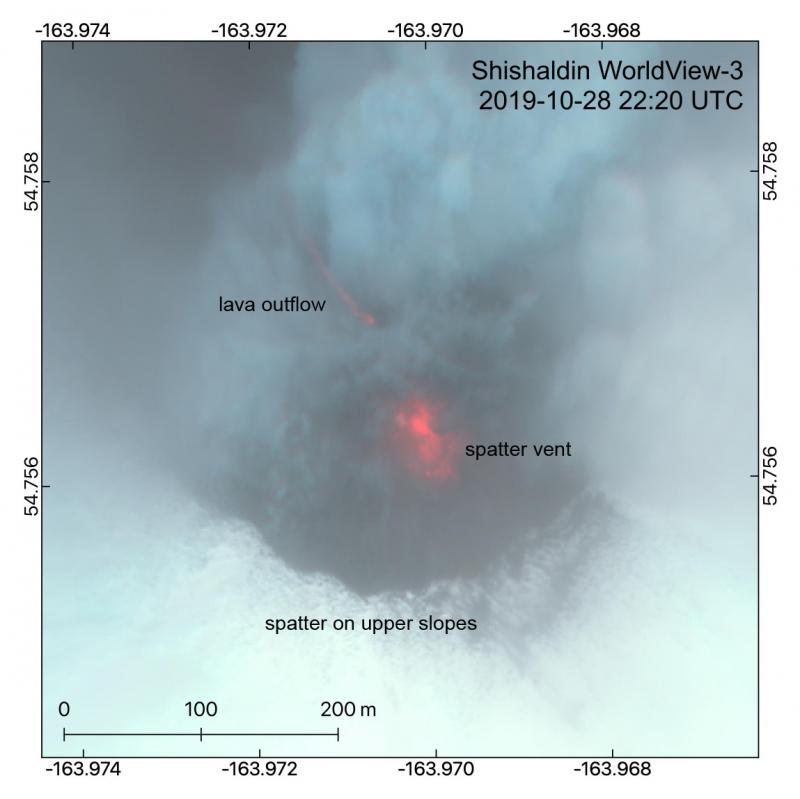
This near-infrared multispectral DigitalGlobe image from October 28 22:20 UTC shows the summit crater of Shishaldin. A lava flow spilling out of the crater can be seen on the northwest side. The central spatter cone is cloaked in steam within the crater, with a steam plume drifting to the NE and deposits of spatter on snow on the upper slopes. Credit: Hannah Dietterich
A transition on the morning of November 1, however, from small explosions to continuous seismic tremor suggested a change in eruptive behavior, and 'additional lava flows and lahars remain possible,' AVO said November 1.
Shishaldin on November 1, 2019. Credit: ESA/Sentinel-2, Antonio Vecoli
Seismicity remained elevated into November 2 with periods of high-amplitude tremor recorded on the local seismic network. Small explosions have also been observed on local seismic stations and detected in regional infrasound data.
Elevated surface temperatures were visible in several satellite images. Incandescence was observed in overnight webcam images, and a local pilot reported observing a lava flow on the morning of November 2.
Geological summary
The beautifully symmetrical volcano of Shishaldin is the highest and one of the most active volcanoes of the Aleutian Islands. The 2857-m-high (9 379 feet), glacier-covered volcano is the westernmost of three large stratovolcanoes along an E-W line in the eastern half of Unimak Island.
The Aleuts named the volcano Sisquk, meaning "mountain which points the way when I am lost." A steady steam plume rises from its small summit crater. Constructed atop an older glacially dissected volcano, it is Holocene in age and largely basaltic in composition.
Remnants of an older ancestral volcano are exposed on the west and NE sides at 1 500 -1 800 m (4 920 – 5 900 feet) elevation. There are over two dozen pyroclastic cones on its NW flank, which is blanketed by massive aa lava flows.
Frequent explosive activity, primarily consisting of strombolian ash eruptions from the small summit crater, but sometimes producing lava flows, has been recorded since the 18th century. (GVP)
Featured image credit: Sentinel-2, Antonio Vecoli
Commenting rules and guidelines
We value the thoughts and opinions of our readers and welcome healthy discussions on our website. In order to maintain a respectful and positive community, we ask that all commenters follow these rules:
We reserve the right to remove any comments that violate these rules. By commenting on our website, you agree to abide by these guidelines. Thank you for helping to create a positive and welcoming environment for all.