Extensive gas plume seen over Mount Michael, Saunders Island
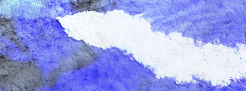
An apparent extensive white gas emission was observed over Mount Michael, Saunders Island on October 10, 2019.
The gas is being blown in an east-southeasterly direction. According to the South Sandwich Islands Volcano Monitoring Blog, the column is most likely just a gas plume since no thermal anomaly was tracked.
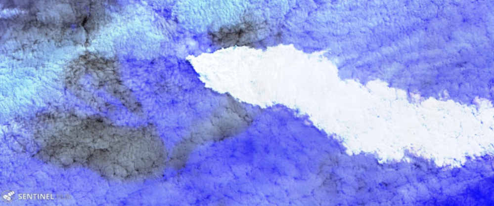
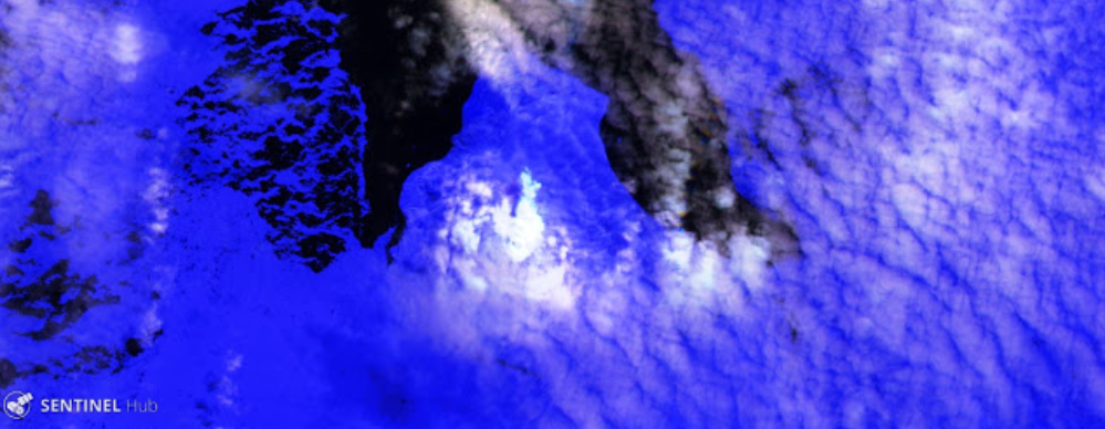
Satellite images of Saunders Island from October 13 to 15 display nothing else than degassing activity on the volcano.
Extensive gas plume drifting ESE on October 10, 2019. Image credit: Sentinel-2/Sentinel Hub.
Degassing activity on October 13, 2019. Image credit: Sentinel-2/Sentinel Hub.
Degassing activity on October 15, 2019. Image credit: Sentinel-2/Sentinel Hub.
Geological summary
Saunders Island is a volcanic structure consisting of a large central edifice intersected by two seamount chains, as shown by bathymetric mapping (Leat et al., 2013).
The young constructional Mount Michael stratovolcano dominates the glacier-covered island, while two submarine plateaus, Harpers Bank and Saunders Bank, extend north. The symmetrical Michael has a 500-m-wide (1 640 feet) summit crater and a remnant of a somma rim to the SE.
Tephra layers visible in ice cliffs surrounding the island are evidence of recent eruptions.
Ash clouds were reported from the summit crater in 1819, and an effusive eruption was inferred to have occurred from an N-flank fissure around the end of the 19th century and beginning of the 20th century.
A low ice-free lava platform, Blackstone Plain, is located on the north coast, surrounding a group of former sea stacks. A cluster of parasitic cones on the SE flank, the Ashen Hills, appears to have been modified since 1820 (LeMasurier and Thomson, 1990).
Vapor emission is frequently reported from the summit crater.
Recent AVHRR and MODIS satellite imagery has revealed evidence for lava lake activity in the summit crater. (GVP)
Featured image credit: Sentinel-2/Sentinel Hub
Natural gas? Is that cloud explosively dense somewhere? Any idea of gas release volume/time?
Things to come: warming marine methane hydrate hypercanes and tsunami?