Tropical Storm “Karen” forms near Windward Islands
Tropical Storm "Karen" formed just east of the Windward Islands at 09:00 UTC on September 22, 2019, as the 11th named storm of the 2019 Atlantic hurricane season. On Average, the 11th named storm forms on October 28.
A Tropical Storm Warning is in effect for Trinidad and Tobago, Grenada and its dependencies, St. Vincent and the Grenadines. A Tropical Storm Watch is in effect for U.S. Virgin Islands, Puerto Rico, including Vieques and Culebra, British Virgin Islands.
At 15:00 UTC, the center of newly formed Tropical Storm "Karen" was located about 45 km (30 miles) N of Grenada and 105 km (65 miles) SSW of St. Vincent. The storm had maximum sustained winds of 65 km/h (40 mph) and minimum central pressure of 1 006 hPa.
Karen was moving WNW at 20 km/h (13 mph) and this general motion is expected to continue today.
A turn toward the NW is forecast on Monday, September 23, followed by a turn toward the north on Tuesday.
Karen moved across the Windward Islands today and is now moving away from it, across the Caribbean Sea.
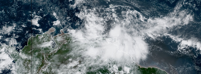
Tropical Storm "Karen" at 14:30 UTC on September 22, 2019. Credit: NOAA/GOES-East
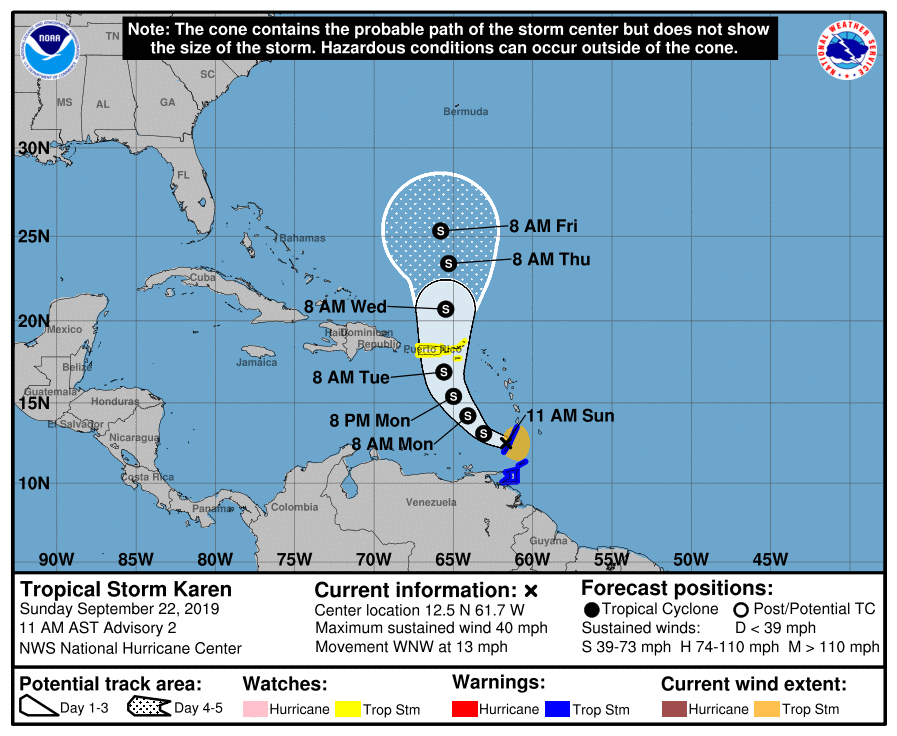
On the forecast track, Karen is expected to approach Puerto Rico and the Virgin Islands on Tuesday.
Karen is expected to produce the following rainfall accumulations through Wednesday:
- Windward Islands: 75 – 150 mm (3 to 6 inches), isolated 200 mm (8 inches).
- Leeward Islands: 25 – 75 mm (1 to 3 inches), isolated 125 mm (5 inches).
- Far northeastern Venezuela and Barbados: 25 – 75 mm (1 to 3 inches).
These rains may cause flash flooding and mudslides, especially in mountainous areas.
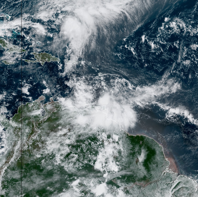
Featured image: Tropical Storm "Karen" at 14:30 UTC on September 22, 2019. Credit: NOAA/GOES-Eas
Commenting rules and guidelines
We value the thoughts and opinions of our readers and welcome healthy discussions on our website. In order to maintain a respectful and positive community, we ask that all commenters follow these rules.