Tropical Storm “Podul” (Jenny) about to make landfall in Philippines
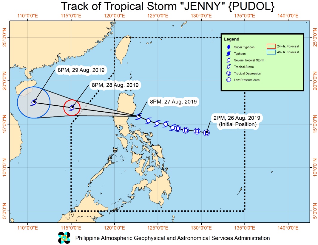
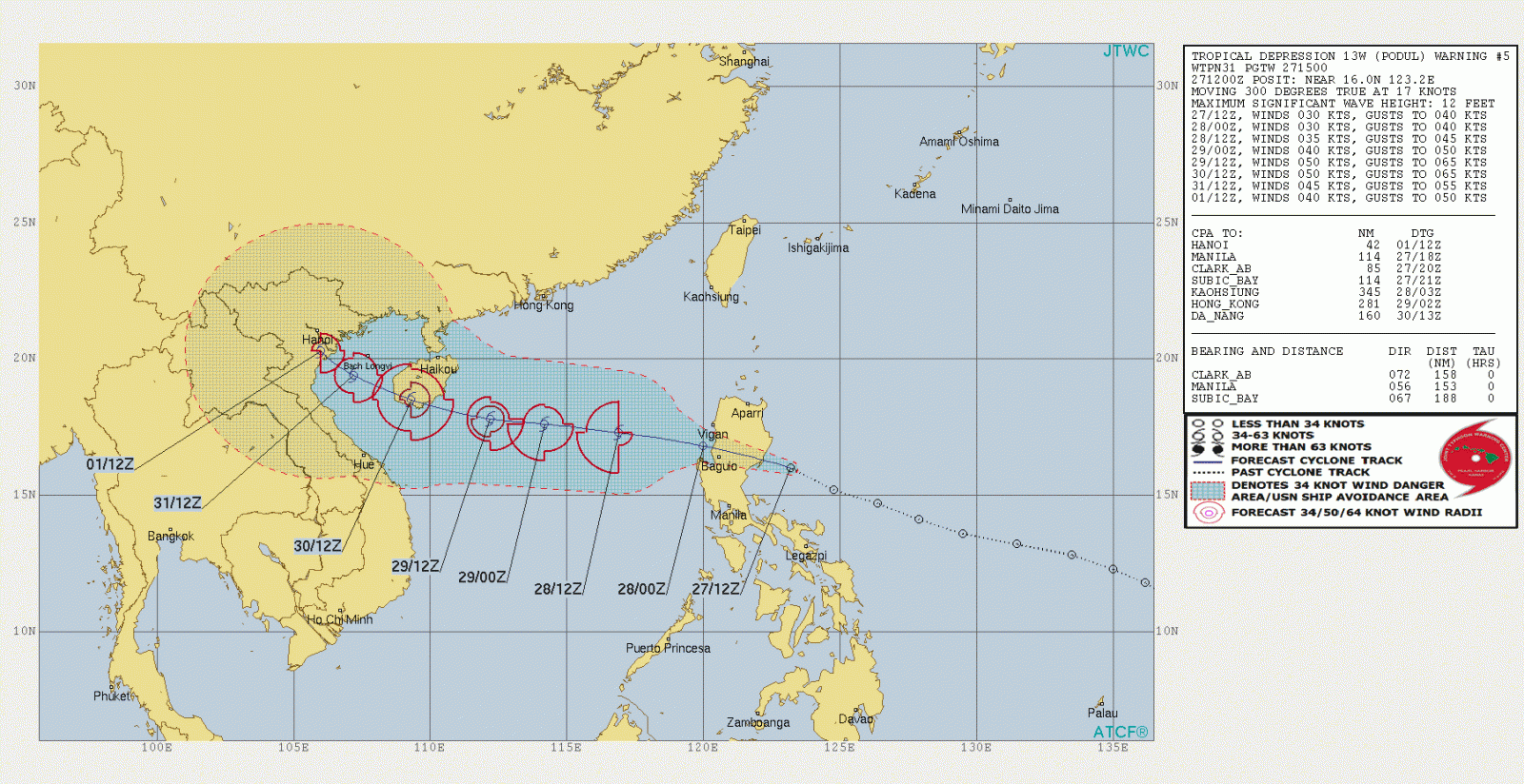
Tropical Storm "Podul," named Jenny in the Philippines, formed in the West Philippine Sea on August 26, 2019. The system is expected to hit Aurora Province, Philippines between 21:00 LT on August 27 and 01:00 LT on August 28. China and Vietnam are also under heavy typhoon threat.
At 20:00 (LT) today, the center of Tropical Storm "Podul" was estimated based on all available data in the coastal waters of Casiguran, Aurora (at 16.0 °N, 122.2 °E ).
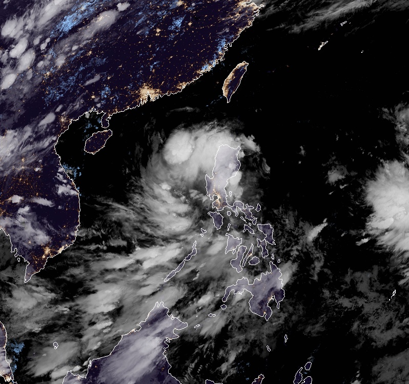
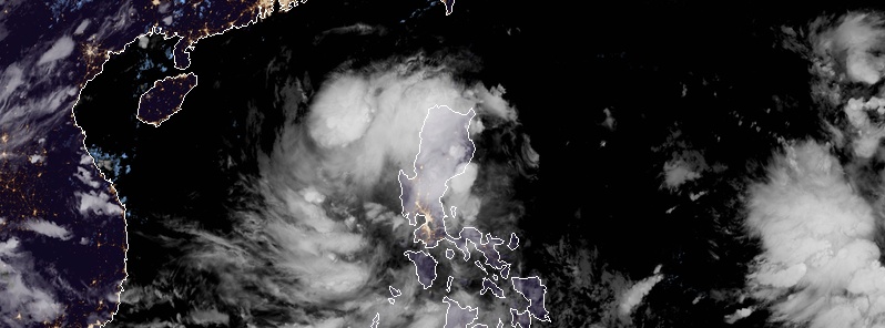
Tropical Storm "Podul" at 13:20 UTC on August 27, 2019. Credit: JMA/Himawari-8
The system is moving WNW at 35 km/h (21 mph) with maximum sustained winds of 65 km/h (40 mph) near the center and gusts to 90 km/h (55 mph), PAGASA said in their latest bulletin issued 23:00 LT (15:00 UTC) today.
- Podul (Jenny) will make landfall in the vicinity of Casiguran, Aurora in the next 2 hours. Weakening into a Tropical Depression following landfall is likely.
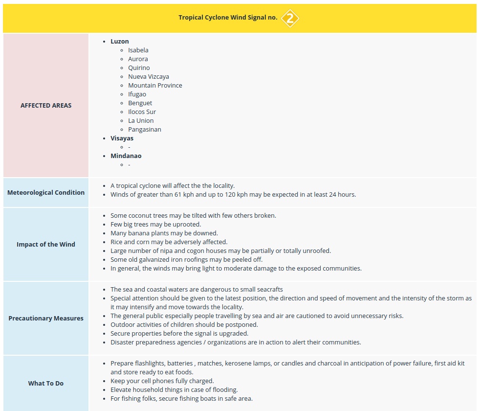
- Between tonight and tomorrow (August 28) morning: Intermittent to frequent moderate to heavy rains over Ilocos Region, Cordillera Administrative Region, Cagayan, Isabela, Quirino, Nueva Vizcaya, and Aurora. Light to moderate with intermittent heavy rains over Metro Manila, CALABARZON, MIMAROPA, Western Visayas, Zamboanga Peninsula, and the rest of Cagayan Valley and Central Luzon.
- Between tomorrow morning and Thursday (August 29) morning: Light to moderate with intermittent to occasionally heavy rains due to Southwest Monsoon over Western Visayas, Mindoro Provinces, the northern portion of Palawan (including Calamian and Cuyo Islands), Zambales and Bataan.
- Residents in the aforementioned areas, especially those living in areas identified to be highly or very highly susceptible to floods and rain-induced landslides, are advised to take precautionary measures, coordinate with local disaster risk reduction and management offices, and continue monitoring for updates, especially the Thunderstorm Advisories and Heavy Rainfall Warnings to be issued by PAGASA Regional Services Divisions.
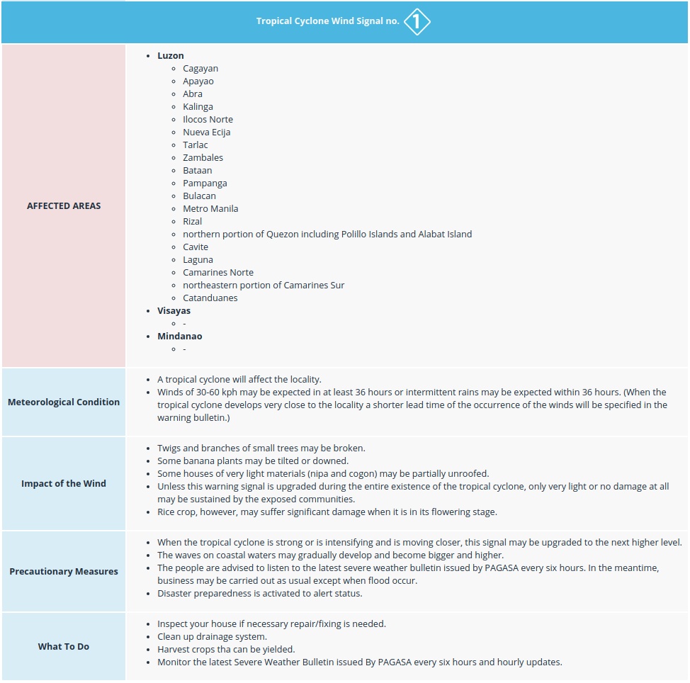
- Areas under TCWS #2 are advised to take precautionary measures against potentially strong winds. Gusty conditions may occur over areas under TCWS #1. Occasional gusts may also be experienced in Visayas and in other areas of Luzon due to the Southwest Monsoon.
- Sea travel remains risky over the seaboards of areas under TCWS and seaboards of Batanes and Babuyan Islands due to potentially rough sea conditions.
Classes have been suspended since Monday as the heavy rain is leading to floods and mudslides.
Moreover, PAGASA expects the heaviest typhoon on Wednesday morning to be followed by weaker tropical depression later in the afternoon.
Jenny is expected to exit the Philippine area by Thursday if it will keep heading west at 25 km/h (15 mph), PAGASA stated. The storm will also be heading to China and Vietnam later this week.
Featured image: Tropical Storm "Podul" at 13:20 UTC on August 27, 2019. Credit: JMA/Himawari-8
Commenting rules and guidelines
We value the thoughts and opinions of our readers and welcome healthy discussions on our website. In order to maintain a respectful and positive community, we ask that all commenters follow these rules:
We reserve the right to remove any comments that violate these rules. By commenting on our website, you agree to abide by these guidelines. Thank you for helping to create a positive and welcoming environment for all.