Anak Krakatau volcano alert level raised to 3 of 4, more tsunamis possible, Indonesia
Volcanic activity at Anak Krakatau continues increasing, forcing Indonesian authorities to raise the alert level from 2 to 3 (of 4) at 23:00 UTC on December 26, 2018 (06:00 WIB, December 27). More tsunamis are possible and BMKG recommends communities to stay 500 m – 1 000 m (0.3 – 0.6 miles) away from the coast.
The danger zone was extended from 2 km (1.2 miles) to 5 km (3.1 miles), prohibiting any activity within the new danger zone.
Air traffic control agency AirNav Indonesia said it was closing flight routes because the volcanic ash Krakatau was spewing meant the situation was on "red alert."
An AirNav operations manager told the BBC that between 20 and 25 flights were affected, including some international flights to and from Australia, Singapore and the Middle East.
He said that the disruption was likely to be minimal, although passengers may experience longer journeys and aircraft may need more fuel because of the diversions.
Angin dominan ke arah barat daya membawa abu vulkanik erupsi Gunung Anak Krakatau dominan. Namun pada ketinggian tertentu angin ada yang ke arah timur sehingga hujan abu dan pasir tipis di Cilegon dan sebagian Serang. Status Gunung Anak Krakatau masih Waspada (Level 2). pic.twitter.com/P4eXQd8rcw
— Sutopo Purwo Nugroho (@Sutopo_PN) December 26, 2018
Deadly tsunami produced around 21:30 LT on December 22 (14:30 UTC) was likely caused by west-southwest slope flank collapse, authorities said.
According to data provided by the country's disaster management agency on December 29, at least 431 people have been killed, 7 200 were injured and 15 are still missing after a tsunami hit villages located around Sunda Strait. 46 646 people have been displaced.
At least 1 778 homes have been damaged, 69 hotels were severely damaged as well as 78 small commercial units and 434 boats and ships.
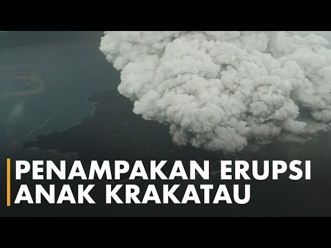
According to the Darwin VAAC advisory issued 00:25 UTC, December 23, satellite imagery suggested a high-level eruption, with ash rising up to 16.7 km (55 000 feet) above sea level.
Perbandingan citra satelit Alos sebelum dan setelah dari tubuh Gunung Anak Krakatau tsunami di Selat Sunda 22/12/2018. Nampak lereng sisi barat daya Gunung Anak Krakatau runtuh yang diduga menyebabkan longsor bawah laut sehingga memicu tsunami. pic.twitter.com/O60dGIXujr
— Sutopo Purwo Nugroho (@Sutopo_PN) December 26, 2018
Comparison of @planetlabs images of south flank of #Krakatau #volcano on May 22 and Dec 17, 2018.https://t.co/C5v4EPK59l pic.twitter.com/cCcAN0yMw6
— Simon Carn (@simoncarn) December 23, 2018
More tsunamis are possible and BMKG recommends communities to stay 500 m – 1 000 m (0.3 – 0.6 miles) away from the coast.

"I have come to the conclusion that during the afternoon of 22th December, I witnessed the most intense eruptive activity I have observed at Anak-Krakatau," said photographer Øystein L. Andersen, who was on the coast of Java with his family when the tsunami hit. In fact, it was due to his reports that people around the world begin to understand what actually took place.
"I have been following the eruption cycle since it started in June 2018, trough the CCTV almost daily (when weather conditions allowed it and when it was operational) and I have visited Krakatau 2 times in 2018, but also observed it 3 times erupting from the coast of Java. (Last time being in November)."
I have written a detailed account on my observations of the eruption of #Krakatau and the Tsunami on the 22th December, for those interested to read. The account also contains many photos, and links to video footage. #Indonesia @id_magma @infoBMKG https://t.co/VUZJDHnFZx pic.twitter.com/HrXCSJ6AOi
— Øystein L. Andersen (@OysteinLAnderse) December 27, 2018
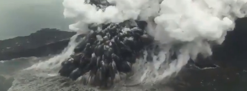
Featured image credit: Sutopo Purwo Nugroho
The feast is coming! 52×70 weeks of years = 2019 DECEMBER 30th at 12:00 mednigh NEW BEGINNINGS! I DO NOT KNOW BUT WE WILL SEE!