Potent winter storm to bring ice and snow from Southern Plains to Appalachians, US
A developing storm will track across the Southern Plains Friday, December 7 to the Southeast states and possibly the Mid-Atlantic Coast through Sunday, December 9. On the warmer side of the storm, heavy rainfall could cause flooding of low lying areas, particularly from Southeast Texas into western Louisiana. Along the northern edge of the storm, potential exists for heavy snow, ice, and dangerous travel conditions.
A cold front stretching from the Great Lakes to Texas will bring light to moderate snow accumulations downwind of the Great Lakes as well as in parts of the northern and central Appalachians, NWS forecaster Santorelli notes.
This cold front will usher in a reinforcing shot of cold air into the central states, with afternoon highs on Thursday and Friday 5 – 15 °C (10 to 25 °F) below normal, especially across the Texas Panhandle and into Oklahoma.
The cold outbreak will set the stage for a winter storm developing by Friday from eastern New Mexico into western Oklahoma and eventually points east. This winter storm has been named Diego by The Weather Channel.
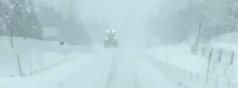
Snow and ice accumulations from this storm will be expansive, extending from the southern Plains to the Ozarks, Ohio Valley and the southern half of the Appalachian Mountains, TWC meteorologists said. Major snow and ice accumulations will cause travel impacts across a widespread area while ice accumulations could cause power outages and tree damage.
As the upper level system from the Western U.S. pushes eastward and moisture streams northward ahead of it, precipitation will increase in intensity across the Southern Plains.
Accumulating snow and ice appears likely from eastern New Mexico to western Oklahoma on Friday with snow totals of 100 – 200 mm (4 to 8 inches), with locally higher amounts possible especially across the Texas Panhandle.
A swath of potentially significant ice is also forecast from roughly Lubbock, TX to near Oklahoma City, OK with accumulations in excess of 2.5 to 6.3 mm (0.10 to 0.25 inches) possible.
South of this region, heavy rainfall is likely across eastern Texas into the lower Mississippi Valley.
As rainfall increases in intensity near a developing area of low pressure in southeast Texas, flash flooding will become a threat and WPC has highlighted much of southeast Texas within a slight to moderate risk for excessive rainfall.
This same system will push eastward, spreading hazardous wintry weather from parts of the Mississippi Valley to the Appalachians, and heavy rainfall across the Gulf Coast states and Southeast this weekend.
"The storm may make enough of a northward jog near the Atlantic coast to allow some snow to creep into the Interstate 95 corridor from Washington, D.C., to Philadelphia and New York City at the start of next week," AccuWeather senior meteorologists said. "Rain, thunderstorms and a wintry mix are scheduled to slowly overspread the southeastern U.S. on Saturday."
While the storm will pack quite a punch in the South Central states this weekend, it may hit like a sledgehammer over portions of the Southeast states from Saturday night to Monday, he said. In areas from the mountains of western North Carolina to parts of southern West Virginia and western and central Virginia, this will be a major storm with the potential for a foot or more of snow.
Many flight cancellations are likely at the smaller hubs in the region. Expect major airline delays and flight cancellations in Charlotte, North Carolina, Atlanta and potentially Nashville, Tennessee, and Washington-Dulles Airport.
Motorists heading south along I-81 and I-95 from Pennsylvania and New Jersey toward Virginia should expect to run into wintry weather and progressively worse driving conditions during Sunday night to Monday.
Winter storm watches have been issued by the National Weather Service from parts of the Texas Panhandle to western and central Oklahoma.
Featured image credit: AccuWeather
Commenting rules and guidelines
We value the thoughts and opinions of our readers and welcome healthy discussions on our website. In order to maintain a respectful and positive community, we ask that all commenters follow these rules:
We reserve the right to remove any comments that violate these rules. By commenting on our website, you agree to abide by these guidelines. Thank you for helping to create a positive and welcoming environment for all.