Tropical Storm “Jongdari” forms, landfall expected just south of Tokyo, Japan
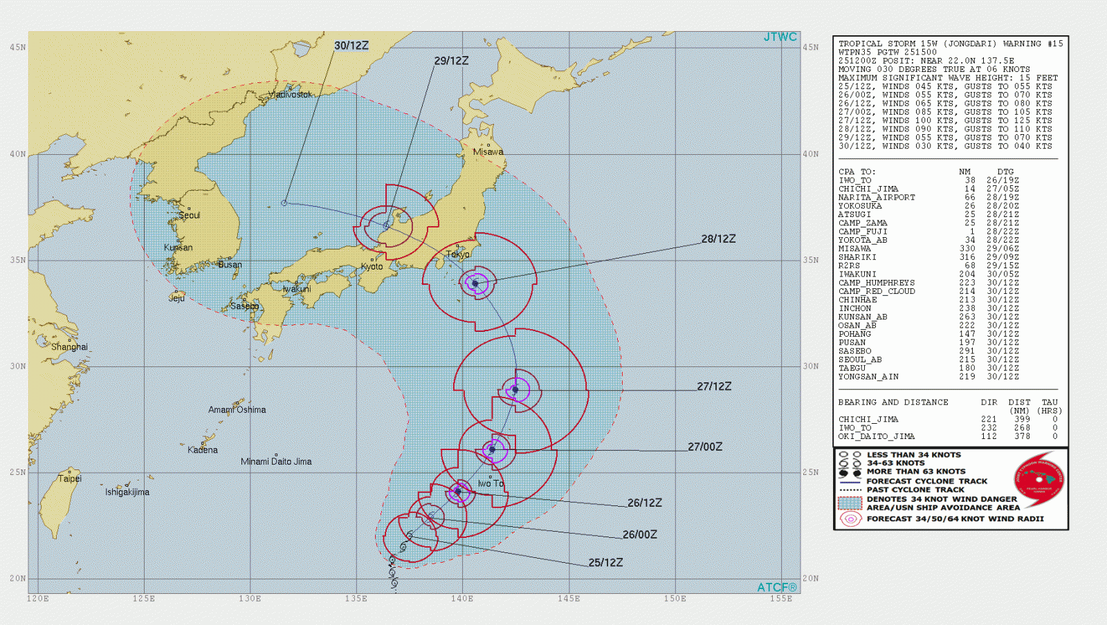
Tropical Storm "Jongdari" formed July 24, 2018, as the 11th named storm of the 2018 Pacific typhoon season. Jongdari continued strengthening on July 25 and is expected to become a typhoon before it makes landfall just south of Tokyo on July 28. There is still plenty of time and uncertainty and the system could still change its track.
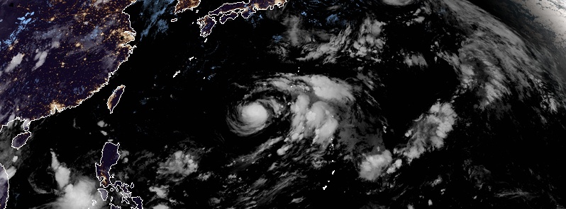
At 15:00 UTC on July 25, the center of Tropical Storm "Jongdari" was located approximately 496 km (308 miles) southwest of Iwo To, Japan and has tracked NNE at 11 km/h (7 mph) over the past 6 hours. Jongdari had maximum sustained winds of 84 km/h (52 mph) at the time, and gusts to 102 km/h (64 mph).
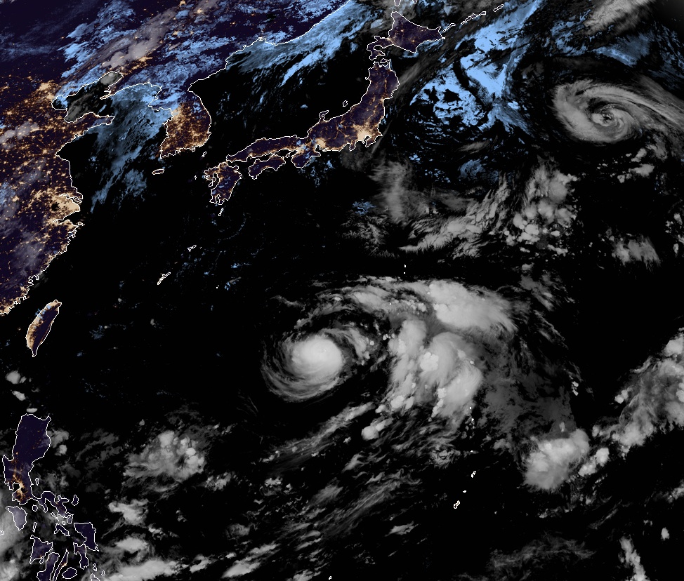
Tropical Storm "Jongdari" at 18:20 UTC on July 25, 2018. Tropical Storm "Wukong" is located east of Japan. However, this storm is weakening and moving away from the country. Credit: JMA/Himawari-8, RAMMB/CIRA
Upper-level analysis performed by JTWC meteorologists indicates a favorable environment with improving poleward and equatorward outflow and low vertical wind shear.
Jongdari is forecast to continue tracking along the northern periphery of the near-equatorial ridge over the next 36 hours. After that, the system will accelerate northeastward to northward through 15:00 UTC, July 28 as the steering ridge to the east strengthens.
During that time, Jongdari is expected to intensify to a peak of 185 km/h (115 mph), turn west and make landfall south of Tokyo sometime on July 28.
However, there is currently a significant uncertainty in the exact trajectory and timing.
Featured image: Tropical Storm "Jongdari" at 18:20 UTC on July 25, 2018. Credit: JMA/Himawari-8, RAMMB/CIRA
Commenting rules and guidelines
We value the thoughts and opinions of our readers and welcome healthy discussions on our website. In order to maintain a respectful and positive community, we ask that all commenters follow these rules.