Tropical Cyclone “Fakir” forms near Madagascar, moves between Reunion and Mauritius
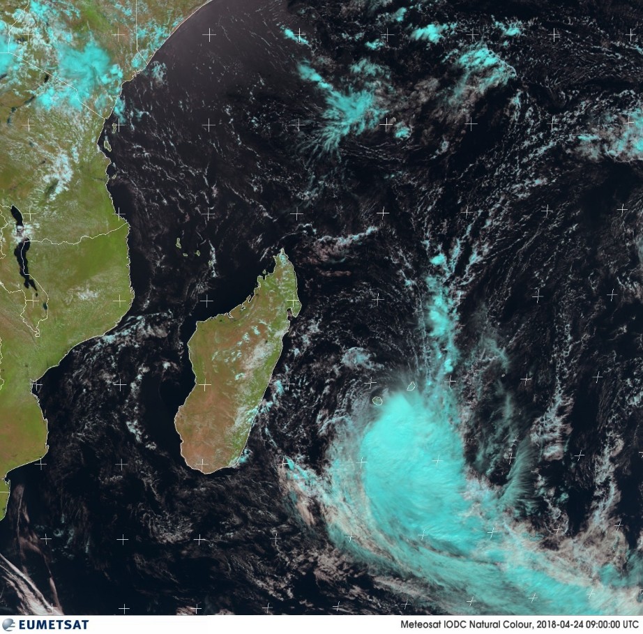
Tropical Cyclone "Fakir" formed near northeastern Madagascar on April 23, 2018 as the 7th named storm of the 2017/18 South-West Indian Ocean cyclone season. Its center has since passed just north of Reunion as a Severe Tropical Storm, dropping heavy rain.
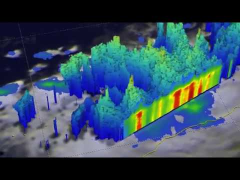
The GPM core observatory satellite flew above the forming late-season tropical cyclone near northeastern Madagascar on April 22, 2018 and its Dual Frequency Precipitation Radar (DPR) instrument revealed that bands of extremely heavy rainfall were spiraling into the tropical low's southeastern side at a rate of over 219 mm (8.6 inches) per hour in some of the strong convective storms that were moving toward Madagascar.
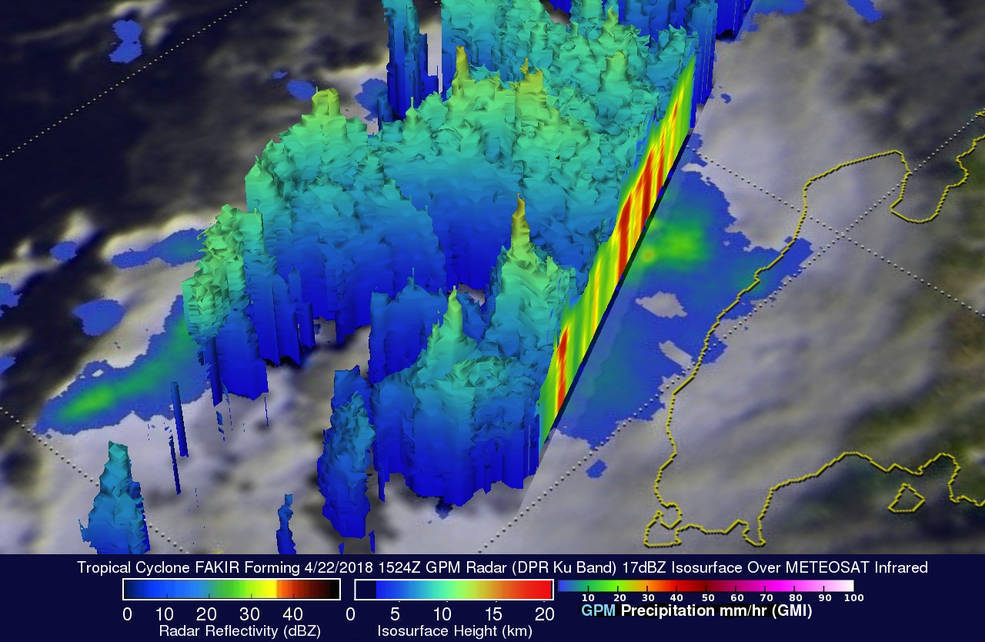
On April 22, GPM showed that bands of extremely heavy rainfall were spiraling into the tropical low's southeastern side. GPM's radar (DPR Ku Band) showed that precipitation was falling at a rate of over 219 mm (8.6 inches) per hour in some of the strong convective storms that were moving toward Madagascar. GPM's radar indicated that a few of the tallest intense convective storms were reaching heights of almost 16 km (9.9 miles). Credit: NASA/JAXA,
GPM's radar also indicated that a few of the tallest intense convective storms were reaching heights of almost 16 km (9.9 miles).
Fakir officially formed at 12:00 UTC on April 23. At 15:00 UTC, the system was moving southeastward with maximum sustained winds near 74 km/h (46 mph). It was located about 580 km (360 miles) north-northwest of St Denis, La Reunion.
"Satellite imagery depicts a rapidly consolidating system with improved deep convective banding wrapping into a well-defined low-level circulation center. Another image showed tightly-curved banding wrapping into a microwave eye feature," JTWC said at the time.
At 05:00 UTC on April 24, the center of Fakir passed about 20 km (12.4 miles) east of Piton Saint-Rose on the eastern coast of La Reunion. The strongest winds have passed very near the eastern coast where an unofficial station reported a 981 hPa near the radius of maximum wind.
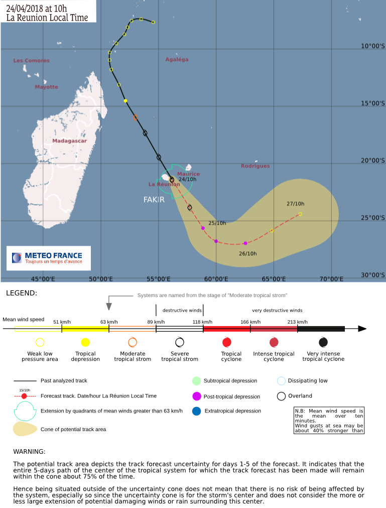
At 06:00 UTC, Fakir was still a Severe Tropical Storm with the maximum average 10-minute wind speed of 111 km/h (69 mph) and central pressure of 977 hPa, according to RSMC La Reunion. The storm was moving SSE at 42 km/h (26 mph).
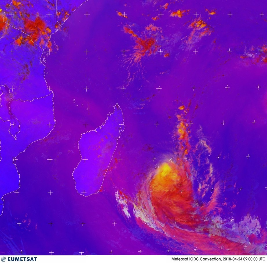
Recent radar imagery suggests that its eye pattern is losing definition and the current strong shear is expected to increasingly impact the system later today
Fakir is expected to transition into post-tropical depression over the next 24 hours.`
Weather conditions over the Mascareignes Islands (Mauritius, Reunion and Rodrigues) and especially La Reunion should improve fastly later today.
Fakir is the 7th named storm of the 2017/18 South-West Indian Ocean cyclone season. The season started on November 15, 2017 and will officially end on April 30, 2018.

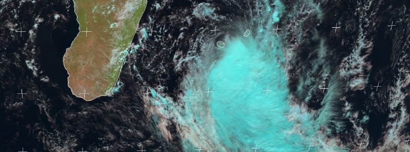
Featured image: TC Fakir on April 24, 2018. Credit: EUMETSAT
Commenting rules and guidelines
We value the thoughts and opinions of our readers and welcome healthy discussions on our website. In order to maintain a respectful and positive community, we ask that all commenters follow these rules:
We reserve the right to remove any comments that violate these rules. By commenting on our website, you agree to abide by these guidelines. Thank you for helping to create a positive and welcoming environment for all.