Winter storm Xanto brought historic April snowfall, US
A powerful late-season winter storm named Xanto by The Weather Channel brought record April snowfall to the upper Midwest and Great Lakes in mid-April 2018.
Xanto was the heaviest April snowstorm on record in Minneapolis/St. Paul, it also was the second-heaviest snowstorm of all-time in Green Bay, Wisconsin.
A historic snowstorm! The April 13th-16th storm (15.8" in the Twin Cities) broke the record for the largest April snowstorm (old record 13.6" on April 14, 1983). It was also the 12th largest snowstorm on record in the Twin Cities! Top 20 snowstorms: https://t.co/XrPSrdvZIl #mnwx pic.twitter.com/UHKAAjt9XH
— NWS Twin Cities (@NWSTwinCities) April 16, 2018
Winter storm Xanto pushed Minneapolis/St. Paul to its snowiest April on record, with 66.3 cm (26.1 inches) of snow as of April 16.
Some extreme ballooning in a blizzard this evening during our twice-daily weather balloon launch. What an effort! pic.twitter.com/Gk963G17yu
— NWS Twin Cities (@NWSTwinCities) April 15, 2018
Green Bay, Wisconsin, received an astonishing 61.47 cm (24.2 inches) of snow between April 13 and 16, ranking not only as the city's heaviest April storm but also the second-heaviest snowstorm of all-time. Blizzard conditions were observed in Green Bay 16:00 UTC – 19:00 UTC (11:00 to 14:00 local time) on April 15.
WOW! Incredible snow drift in Oconto Falls, north of Green Bay. Photo from Thomas Thomson #wiwx #AprilBlizzard pic.twitter.com/LINMvtzTxX
— NWS Green Bay (@NWSGreenBay) April 17, 2018
In north-central Wisconsin, 52.58 cm (20.7 inches) of snow piled up in Wausau, making Xanto the heaviest April snowstorm on record there, as well as the second-heaviest snowstorm of all-time, The Weather Channel said.
Sioux Falls, South Dakota, received 34.8 cm (13.7 inches) of snow from Xanto on April 14, making it the heaviest one-day April snow total on record in the city. The total from the entire storm was 36.3 cm (14.3 inches.)
The highest snowfall total was 83.82 cm (33 inches) in Amherst, Wisconsin. Drifts of 1.52 – 1.83 meters (5 to 6 feet) high were also reported in that location.
Here is a look at the snow totals from the HISTORIC winter storm from late April 13 to early April 16. #wiwx #whereisSpring pic.twitter.com/3KUsFqApDW
— NWS Green Bay (@NWSGreenBay) April 16, 2018
Xanto recap
Xanto hit the northwestern United States on April 11 as a strong mid- to upper-level jet stream disturbance. This disturbance crossed the northern and central Rockies the following day before becoming a strong surface low-pressure system in Kansas and Nebraska on April 13. The sluggish, strong low-pressure system continued to batter the Great Lakes, Midwest, and central Plains April 14 – 15.
Here are some of the top snow and ice reports by state.
Snowfall reports
- Colorado: 36.8 cm (14.5 inches) near Cedaredge, 25.4 cm (10 inches) near Berthoud Falls and Julesburg
- Illinois: 5.6 cm (2.2 inches) in Nora
- Iowa: 40.6 cm (16 inches) in Ruthven; 16.5 cm (6.5 inches) in Sioux City
- Kansas: 12.7 cm (5 inches) in Bird City; 8.12 cm (3.2 inches) near Goodland
- Michigan: 61.9 cm (24.4 inches) near Negaunee
- Minnesota: 68.8 cm (27.1 inches) near Richfield; 40.1 cm (15.8 inches) at Minneapolis/St. Paul International Airport
- Montana: 63.5 cm (25 inches) near Bozeman; 35.5 cm (14 inches) in Grass Range
- Nebraska: 35.5 cm (14 inches) in Newport and Mullen; 27.9 cm (11 inches) near Valentine
- New Hampshire: 5 cm (2 inches) in Berlin
- New York: 5 cm (2 inches) near Chazy
- North Dakota: 15.2 cm (6 inches) in Medora, Hirschville and Dunn Center
- South Dakota: 50.8 cm (20 inches) near Okreek and Winner; 48.2 cm (19 inches) in Huron; 36.3 cm (14.3 inches) in Sioux Falls
- Utah: 71.1 cm (28 inches) in the Alta Ski Area at the summit; 25.4 cm (10 inches) in Brighton and Alta
- Vermont: 6.3 cm (2.5 inches) near Milton; 2.7 cm (1.1 inches) (sleet) near South Burlington
- Wisconsin: 83.8 cm (33 inches) in Amherst; 61.4 cm (24.2 inches) in Green Bay; 52.5 cm (20.7 inches) in Wausau
- Wyoming: 45.7 cm (18 inches) near Alta; 30.4 cm (12 inches) near Jackson and Afton
Ice/freezing rain reports
- Illinois: 4.7 mm (3/16 inch) in Grayslake, Wauconda, Lindenhurst, and Marengo
- Indiana: 4.7 mm (3/16 inch) near Salem Center
- Michigan: 1.5 mm (5/8 inch) near Midland
- Minnesota: 6.35 mm (1/4 inch) near Douglas
- New York: 25.4 mm (1 inch) in Lowville; nearly 1/4 inch in Buffalo
West
April 11 – 13
Strong winds, some in excess of 112 km/h (70 mph), were seen from California to Utah and Wyoming as the jet stream disturbance dropped into the West. A dash of snow was seen in California's Sierra, but heavier snow fell in the Cascades and Utah's Wasatch.
Almost 25.4 cm (10 inches) of snow had accumulated near Great Falls, Montana, and 50.8 – 63.5 cm (20 to 25 inches) of snow was estimated in the Bridger Range north of Bozeman.
Plains/Midwest
April 13 -1 4
Thundersnow and snowfall rates up to 7.62 (3 inches) per hour were reported in South Dakota and western Nebraska. Blizzard and near-blizzard conditions occurred in eastern Colorado, much of Nebraska, much of South Dakota and parts of southwestern Minnesota. Blizzard warnings were issued for parts of six states: South Dakota, Colorado, Nebraska, Kansas, Iowa, and Minnesota.
Several locations – including Imperial, Nebraska, near North Platte, Nebraska, Kit Carson, Colorado, and Goodland, Kansas – reported near-blizzard conditions in eastern Colorado, western Kansas, Nebraska, southern Minnesota and northwestern Iowa.
Most major interstates and roads in South Dakota and western Nebraska were closed due to the conditions on April 13. Interstate 70 in eastern Colorado and Interstate 80 in eastern Wyoming were also closed.
Major blizzard on Hwy 34 near Akron, Colorado. Visibility of about 20 yards #9wx @NWSBoulder pic.twitter.com/n38Es9yc0P
— Cory Reppenhagen (@CReppWx) April 13, 2018
@NWSNorthPlatte Valentine Ne visibility out front door…I expect power to go at anytime its nuts outside. The Nenzel sheriff statement west and south highways blowing has stopped due due to safety concerns.#Newx pic.twitter.com/YovRQRZsHW
— PrairieRider (@RandyinNebraska) April 13, 2018
Whiteout conditions and stranded motorists were reported early April 14 in northwestern Kansas.
Locations, where blizzard conditions were verified, include:
- Burlington/Hale, Colorado (eastern Colorado)
- Valentine, Nebraska (northern Nebraska)
- Alliance, Nebraska (western Nebraska)
- Kearney, Nebraska (southern Nebraska)
- Winner, South Dakota (southern South Dakota)
- Mitchell, South Dakota, reported a thunder blizzard (southeastern South Dakota)
- Sioux Falls/Huron, South Dakota (southeastern South Dakota)
- Worthington, Minnesota (southwestern Minnesota)
- Storm Lake, Iowa (western Iowa)
- Green Bay, Wisconsin (northeastern Wisconsin) – April 15
All of these locations recorded visibility of 400 meters (one-quarter mile) or less and frequent wind gusts at or above 56.3 km/h (35 mph) for at least three hours.
April 15
Buffalo, New York, saw ice accumulate more than two-tenths of an inch April 15. Up to 2.54 mm (1 inch) of ice was reported in Lowville, New York, in the foothills of the Tug Hill Plateau, where a tree was downed and blocking a roadway. Power lines were downed by icing in Monroe County, New York, which is where Rochester is located.
Strong onshore winds caused coastal flooding on the western shore of Lake Erie in southeastern Michigan on the morning of April 15. A dozen homes were evacuated near Luna Pier, Michigan, according to the National Weather Service.
Excellent perspective to see #WinterStormXanto’s handiwork during takeoff from @mspairport! #Xanto pic.twitter.com/WVZ9LSaeR5
— Justin Michaels (@JMichaelsNews) April 16, 2018
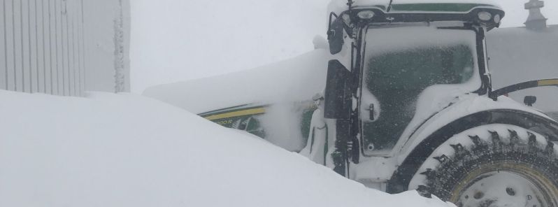
Featured image: Bryan Jorgensen
Commenting rules and guidelines
We value the thoughts and opinions of our readers and welcome healthy discussions on our website. In order to maintain a respectful and positive community, we ask that all commenters follow these rules:
We reserve the right to remove any comments that violate these rules. By commenting on our website, you agree to abide by these guidelines. Thank you for helping to create a positive and welcoming environment for all.