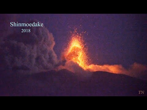
Large explosive eruptions at Mount Shinmoedake, lava flow observed
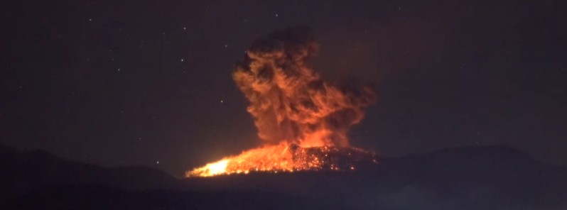
The Japan Meteorological Agency (JMA) issued new warnings for Shinmoedake volcano in Kyushu following a series of explosive eruptions on Friday, March 9, 2018. Explosive eruptions continued into March 10.
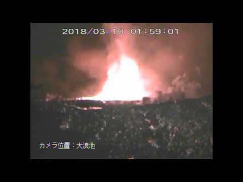
A worker from the National Institute of Advanced Industrial Science and Technology involved in an on-site inspection of Kirishimayama's Shinmoedake crater informed the JMA that lava could be seen flowing from the northwest section of the mountain's crater at 01:10 UTC, March 9 (10:10 JST). The agency later confirmed that lava is flowing over the northwestern side of the volcano.
JMA officials said large volcanic explosions on Friday and Saturday launched large rocks as far as 1.8 km (1.1 miles) from the crater. Ash rose up to 6 km (20 000 feet) above sea level or 4.5 km above the crater, highest since March 1.
In light of this new development, JMA expended its advisory for the Shinmoedake crater for flying rocks from 3 to 4 km (2.5 miles) of the crater, but the Alert Level remains at 3 – people should keep away from the mountain.
The Geospatial Information Authority of Japan said March 9 that lava dome now measures around 650 m (2 132 feet) in diameter, up from about 550 m (1 804 feet) on March 7.
JMA's Fukuoka Regional Headquarters said the latest eruption has striking similarities to one in 2011 and estimates that the volcanic activity will continue for several months.

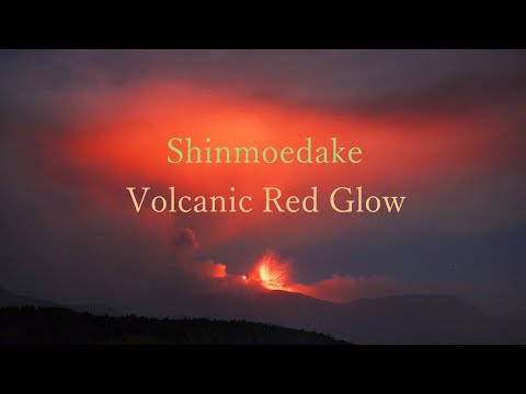
March 9 and 10, 2018
March 8, 2018
March 7, 2018
Live imagery at http://kirishima-live.jpn.org/
Geological summary
Kirishimayama is a large group of more than 20 Quaternary volcanoes located north of Kagoshima Bay. The late-Pleistocene to Holocene dominantly andesitic group consists of stratovolcanoes, pyroclastic cones, maars, and underlying shield volcanoes located over an area of 20 x 30 km (12.4 – 18.6 miles). The larger stratovolcanoes are scattered throughout the field, with the centrally located, 1700-m-high (5 577 feet) Karakunidake being the highest.
Onamiike and Miike, the two largest maars, are located SW of Karakunidake and at its far eastern end, respectively. Holocene eruptions have been concentrated along an E-W line of vents from Miike to Ohachi, and at Shinmoedake to the NE. Frequent small-to-moderate explosive eruptions have been recorded since the 8th century. (GVP)
Featured image: Shinmoedake erupting on March 9, 2018. Image copyright: TN
Commenting rules and guidelines
We value the thoughts and opinions of our readers and welcome healthy discussions on our website. In order to maintain a respectful and positive community, we ask that all commenters follow these rules:
We reserve the right to remove any comments that violate these rules. By commenting on our website, you agree to abide by these guidelines. Thank you for helping to create a positive and welcoming environment for all.