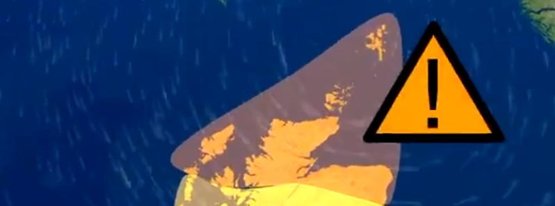
Storm Caroline to hit Scotland with heavy rain and powerful winds, UK

Storm Caroline is expected to bring heavy rain and strong winds to parts of northern and western Scotland on Thursday morning, December 7, 2017. Snow is expected across much of Scotland, Northern Ireland, Wales and parts of northern and western England.
The UK Met Office has issued an Amber National Severe Weather Warning for wind for the far north of Scotland with gusts quite widely expected of around 112 – 129 km/h (70 – 80 mph) and 145 km/h (90 mph) in more exposed areas.
Meanwhile, a Yellow warning has also been issued for wind covering parts of central and southern Scotland and the extreme north of Northern Ireland with wind gusts of 96 – 112 km/h (60 – 70 mph) expected quite widely across the warning area and up to 129 km/h (80 mph) in the more exposed north-facing coastal locations.
The warnings area which extends from 08:00 local time Thursday until midnight includes most of the Western Isles, the Northern Isles and the majority of mainland Scotland from Oban to Aberdeen.
Snow showers will turn increasingly frequent and heavy through the day.
Met Office warns that strong winds may affect Scotland’s road, rail, air and ferry services, and that longer journey times and cancellation of services are possible.
Within the amber warning area flying debris could be an issue and some damage to buildings is possible, such as tiles blowing off roofs. As with any period of strong winds, there may be some short-term loss of power and effects on other services. In addition, it is likely that some coastal routes, sea fronts and coastal communities will be affected by spray and/or large waves.
#StormCaroline will bring a spell heavy rain and damaging winds with the greatest impacts likely for Scotland and the far north of Northern Ireland on Thursday #weatheraware pic.twitter.com/6hAYRYVcU8
— Met Office (@metoffice) December 6, 2017
Wet and windy during the morning rush hour tomorrow, with damaging winds across Scotland. Take care and stay #weatheraware pic.twitter.com/22KDQ5Ufwf
— Met Office (@metoffice) December 6, 2017
Yellow warning for #snow and #ice on Friday and Saturday. Significant amounts are possible across #Scotland, #Northern Ireland, north #Wales and the northwest #Midlands pic.twitter.com/q6yy34f9pQ
— Met Office (@metoffice) December 6, 2017
A Yellow National Severe Weather Warning for snow and ice is in effect for Friday, December 8. The warning covers much of Scotland, Northern Ireland, Wales and parts of northern and western England.
Between 2 and 5 cm (0.8 – 2 inches) of snow is likely fairly widely, with 10 – 20 cm (4 – 8 inches) in places mainly northern Scotland, Northern Ireland, north Wales and perhaps the northwest Midlands.
Icy surfaces are also likely to be an additional hazard, especially overnight and during the morning. Strong northwest winds may cause blizzard conditions at times across northern Scotland. The heaviest and most frequent of the snow showers will progressively become confined to northeast Scotland during Saturday, December 9.
Featured image credit: UK Met Office

Commenting rules and guidelines
We value the thoughts and opinions of our readers and welcome healthy discussions on our website. In order to maintain a respectful and positive community, we ask that all commenters follow these rules:
We reserve the right to remove any comments that violate these rules. By commenting on our website, you agree to abide by these guidelines. Thank you for helping to create a positive and welcoming environment for all.