Intensifying winter storm to hit Rockies to Northern Plains and Upper Midwest
A major weather pattern change is about to hit parts of the United States as an intensifying storm system brings heavy snow, strong winds, blizzard conditions, and dangerous travel from the Rockies to the Northern Plains and Upper Midwest early this week.
A strong storm over the Middle Missouri Valley will advance northeastward into Central Ontario by Tuesday evening, the National Weather Service said early Monday.
The system will produce snow over parts of the Northern/Central Rockies ending by Monday evening local time, December 4. Snow will also develop over the Northern Plains expanding into parts of the Upper Mississippi Valley by Monday evening with the snow becoming heavy. The heavy snow will expand into parts of the Upper Great Lakes overnight Monday with the heavy snow moving into Southwestern Ontario on Tuesday into Tuesday afternoon, December 5. Light snow will continue over parts of the Upper Great Lakes Tuesday afternoon into Tuesday evening.
In addition, showers and thunderstorms will develop over parts of the Upper/Middle Mississippi Valley into parts of the Upper Great Lakes on Monday morning. Showers and thunderstorms will also expand southward along the associated front over the Middle Mississippi Valley into parts of the Southern Plains by Monday evening.
On Tuesday, showers and thunderstorms will move into the Lower Mississippi Valley that will become confined to the Central Gulf Coast by Tuesday evening. Additionally, rain that will be heavy at times will move into the Upper Great Lakes late Monday morning into Monday evening.
Overnight Monday, the rain will move eastward into the Lower Great Lakes to parts of the Lower Mississippi Valley/Southern Plains. On Tuesday, rain will develop over parts of the Mid-Atlantic/Northeast as the rain along the front moves eastward to the Northeast roughly southwestward to the Central/Southern Appalachians into the Lower Mississippi Valley by Tuesday evening.
"The heaviest snow will fall across eastern North Dakota and northern Minnesota Monday and Monday night, with lighter snow continuing into Tuesday; high snow rates throughout the day Monday can lead to snow-covered and slippery roads," AccuWeather Meteorologist Maura Kelly warned.
“Drivers should give themselves extra time in slow travel conditions, or avoid traveling Monday, especially in areas of highest snowfall,” Kelly said.
Meanwhile, a secondary front will move southward out of West-Central Canada moving into the Middle Mississippi Valley by Tuesday evening. Light snow will develop over parts of the Northern High Plains overnight Monday moving into parts of the Northern Plains by Tuesday evening.
Elsewhere, moisture from the Western Gulf of Mexico will move northward over the Southern Plains as upper-level energy moves eastward over the Lower Mississippi Valley and dissipating over parts of the Southeast overnight Monday. The energy and moisture will aid in producing showers and thunderstorms over parts of the Western Gulf Coast/Southern Plains on Monday that will expand into parts of the Lower Mississippi Valley overnight Monday.
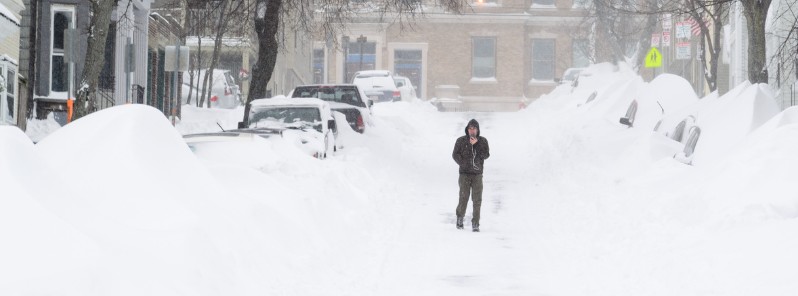
Featured image: Blizzard. Credit: Eric Oak (Flickr)
Sorry but this fall has been near the warmest fall on record in my state. September acted like the worst of July. October was very warm. November was warmer than normal. Since 2009 I’ve seen more 50 degree days in December and January than snow storms (BTW, Zero in my area of the state). Global climate change is here and the weather is NOTHING like 25 years past.