Shallow M6.3 earthquake hits Ascension Island region
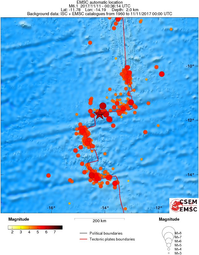
A strong and shallow earthquake registered by the USGS as M6.3 hit Ascension Island region at 00:36 UTC on November 11, 2017. The agency is reporting a depth of 10 km (6.2 miles). EMSC is reporting M6.1 at a depth of 2 km (1.2 miles).
According to the USGS, the epicenter was located 423.4 km (263.1 miles) S of Georgetown (population 538), Saint Helena and 1 918.5 km (1 192 miles) SSW of Harper (population 32 661), Liberia.
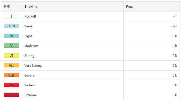
There are no people living within 100 km (62 miles). Some 1 000 people are estimated to have felt weak shaking.
Tsunami is not expected.
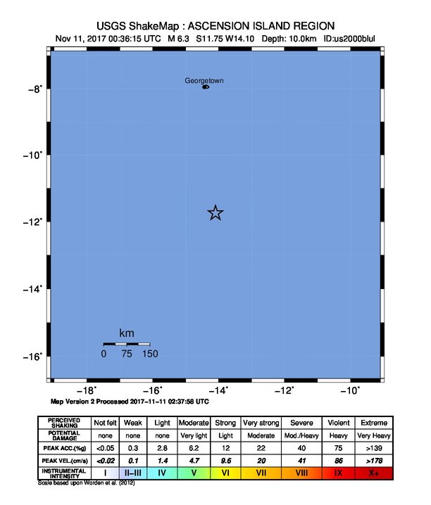 USGS issued a green alert for shaking-related fatalities and economic losses. There is a low likelihood of casualties and damage.
Overall, the population in this region resides in structures that are a mix of vulnerable and earthquake resistant construction. The predominant vulnerable building types are mud wall without wood and informal (metal, timber, GI etc.) construction.
Estimated population exposure to earthquake shaking
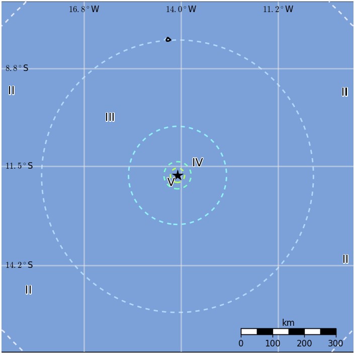
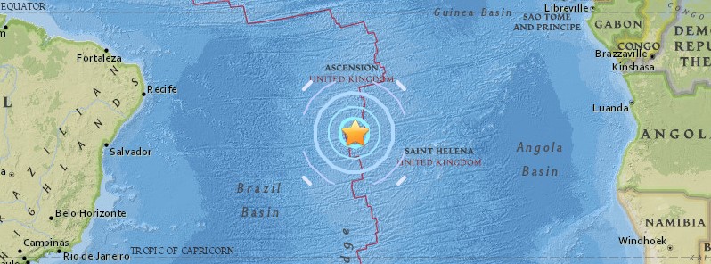
Regional seismicity
Featured image credit: USGS
Commenting rules and guidelines
We value the thoughts and opinions of our readers and welcome healthy discussions on our website. In order to maintain a respectful and positive community, we ask that all commenters follow these rules:
We reserve the right to remove any comments that violate these rules. By commenting on our website, you agree to abide by these guidelines. Thank you for helping to create a positive and welcoming environment for all.