Tropical Storm “Khanun” passing over Philippines, heading toward Hainan and flood-ravaged Vietnam
Tropical Storm "Khanun" formed October 12, 2017 just east of the northern Philippines as the 20th named storm of the 2017 Pacific typhoon season, 24th if you count those named by PAGASA. The system will make landfall in the northern Philippines today, exit into the South China Sea and strengthen as it heads toward Hainan and flood-ravaged Vietnam. Khanun is known in the Philippines as Odette.
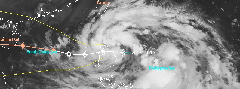
At 15:00 UTC on October 12, the center of Tropical Storm "Khanun" was located 431 km (268 miles) NE of Manila, Philippines. Its maximum sustained winds were 65 km/h (40 mph) with gusts to 83 km/h (52 mph).
Khanun (Odette) is moving westward at 16 km/h (9 mph) and is about to make landfall over Santa Ana, Cagayan sometime between 15:00 and 18:00 UTC today.
TCWS signal #2 is in effect for Batanes and Cagayan, including Babuyan group of islands, Apayao and Ilocos Norte. Signal #2 is in effect for Isabela, Abra, Kalinga, Mountain Province, Ifugao and Ilocos Sur.
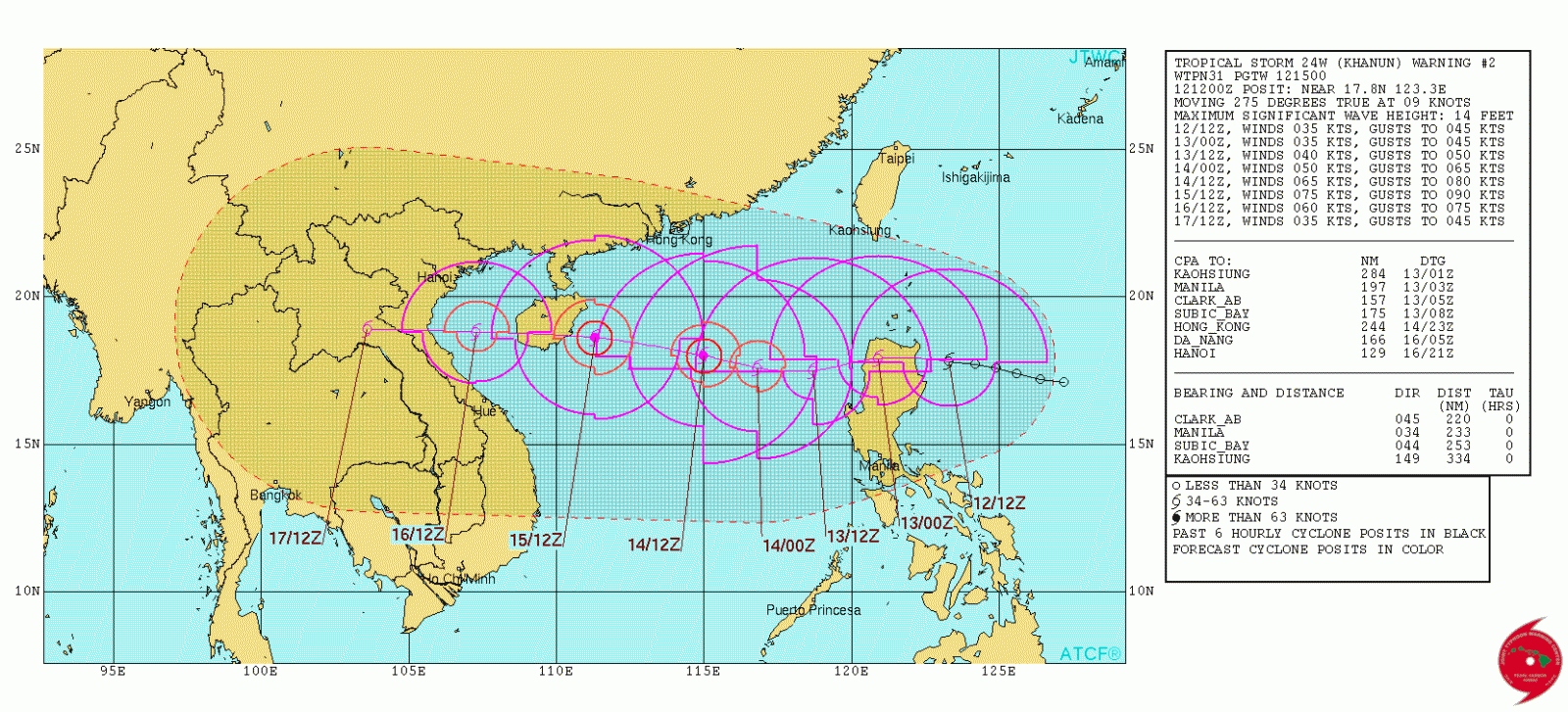
Tropical Storm "Khanun" by JTWC forecast track October 12, 2017
According to PAGASA, estimated rainfall amount is from moderate to heavy within 350 km (217 miles) from the center.
Khanun is expected to keep tracking westward as it remains on the southern periphery of the deep-layered subtropical ridge, JTWC noted.
The storm will maintain its intensity as it transits over Luzon and intensify upon entering the South China Sea. Over the next 24 hours, Khanun will increase to 74 km/h (46 mph) as it moves farther from Luzon and out over warm ocean water with sea surface temperatures of 29 – 30 °C (84.2 – 86 °F).
By 13:00 UTC on October 14, Khanun is expected to start moving WNW, reach a peak intensity of 140 km/h (87 mph) by 15:00 UTC on October 15 and make a landfall in southern Hainan just after that.
The system will make landfall again in northern Vietnam on October 16 (UTC) and weaken rapidly as it moves inland.
Featured image: Tropical Storm "Khanun" at 13:30 UTC on October 12, 2017. Credit: UW-CIMSS
Commenting rules and guidelines
We value the thoughts and opinions of our readers and welcome healthy discussions on our website. In order to maintain a respectful and positive community, we ask that all commenters follow these rules:
We reserve the right to remove any comments that violate these rules. By commenting on our website, you agree to abide by these guidelines. Thank you for helping to create a positive and welcoming environment for all.