Large explosive eruption ejects ash 10.6 km (35 000 feet) a.s.l., Bogoslof
A large explosive eruption began at Bogoslof volcano, Alaska at 07:36 UTC on March 8, 2017 and resulted in approximately 3 hours of significant ash emissions. The eruption comes after two weeks of relative calm.
The intensity of activity as observed in seismic, infrasound and lightning data declined around 10:30 UTC. A large volcanic ash cloud is visible in satellite data and is moving towards the east at an altitude of 10.6 km (35 000 feet) above sea level.
Significant lightning activity, typical for large ash-rich eruption plumes, was also detected on satellite data.
The volcano remains at a heightened state of unrest and a return to more vigorous eruptive activity could occur at any time, AVO said.
The National Weather Service (NWS) has issued a Special Weather Statement for trace amounts (less than 1 mm) of ashfall on Unalaska Island including the community of Dutch Harbor/Unalaska based on ash fallout modeling by the AVO.
The agency has also issued a Marine Advisory for volcanic ashfall on coastal waters near Bogoslof. A SIGMET warning for aviation is in effect for the volcanic cloud at an altitude of 35 000 feet above sea level.
The Aviation Color Code remains at RED and the Alert Level remains at WARNING.
Geological summary
Bogoslof is the emergent summit of a submarine volcano that lies 40 km north of the main Aleutian arc. It rises 1500 m above the Bering Sea floor. Repeated construction and destruction of lava domes at different locations during historical time has greatly modified the appearance of this "Jack-in-the-Box" volcano and has introduced a confusing nomenclature applied during frequent visits of exploring expeditions.
The present triangular-shaped, 0.75 x 2 km island consists of remnants of lava domes emplaced from 1796 to 1992. Castle Rock (Old Bogoslof) is a steep-sided pinnacle that is a remnant of a spine from the 1796 eruption. Fire Island (New Bogoslof), a small island located about 600 m NW of Bogoslof Island, is a remnant of a lava dome that was formed in 1883. (GVP)
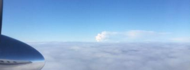
Featured image: Bogoslof's eruption plume, February 17, 2017, as viewed from an airplane landing in Dutch Harbor. Photo courtesy of Virginia Hatfield.
Commenting rules and guidelines
We value the thoughts and opinions of our readers and welcome healthy discussions on our website. In order to maintain a respectful and positive community, we ask that all commenters follow these rules:
We reserve the right to remove any comments that violate these rules. By commenting on our website, you agree to abide by these guidelines. Thank you for helping to create a positive and welcoming environment for all.