Tropical Cyclone “Alfred” forms in the Gulf of Carpentaria, Australia
Tropical Cyclone "Alfred" has formed in the Gulf of Carpentaria, Australia on February 20, 2017. This is the second named tropical system of the 2016/17 Australian region tropical cyclone season. Alfred is slow-moving storm edging closer to the coast of Northern Territory and Queensland and is expected to make landfall today. Abnormally high tides are expected for the southern Gulf of Carpentaria coast over the next few days. Many catchments of the Carpentaria Coastal Rivers are saturated from monsoonal conditions over the past two weeks and are responding strongly to further rainfall.
Alfred reached Category 1 status on the Australian tropical cyclone intensity scale today (63 – 88 km/h / 39 – 54 mph) and is expected to remain at that strength as it makes landfall later tonight (local time), between Borroloola and the NT/Queensland border.
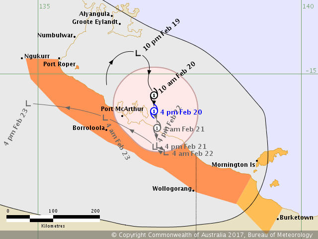
Tropical Cyclone "Alfred" forecast track by BOM on February 20, 2017
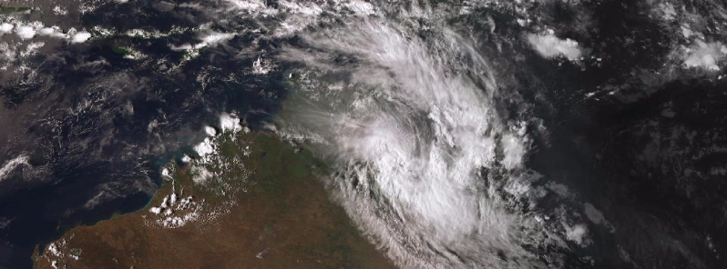
Tropical Cyclone "Alfred" at 09:50 UTC on February 20, 2017. Credit JMA/Himawari, BOM
At 03:00 UTC today, the center of Tropical Cyclone "Alfred" was located approximately 733 km (455 miles) ESE of Darwin, and has tracked ESE at 5.5 km/h (3.4 mph), according to the JTWC. Maximum sustained winds at 00:00 UTC today were 74 km/h (46 mph). There is a limited opportunity for the system to intensify further in the next 12 hours to 83 km/h (51.8 mph), JTWC said earlier today. However, proximity to the land will hinder further development and the system is expected to fully dissipate over land by 03:00 UTC on February 22.
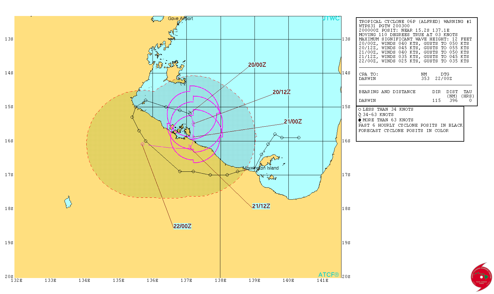
Tropical Cyclone "Alfred" forecast track by JTWC on February 20, 2017
At 05:00 UTC (15:30 ACST), sustained winds near the center of Alfred were reaching 85 km/h (52.8 mph) with wind gusts to 120 km/h (74 mph), according to the BOM. The system was located 105 km (65 miles) ENE of Borroloola and 225 km (140 miles) E of Alyangula. It was moving at 6 km/h.
Gales with gusts to 110 km/h (68 mph) are occurring at the Centre Island, and expected to affect coastal and island communities between Port McArthur and Mornington Island later today (local time) as the cyclone edges closer to the coast.
Heavy rain which may lead to flooding is occurring over the eastern Carpentaria District (NT) and Gulf Country District (Qld). Showers and thunderstorms with isolated heavy falls are possible over areas further inland, BOM warned.
Abnormally high tides are expected for the southern Gulf of Carpentaria coast over the next few days, but are not likely to exceed the highest tide of the year. Large waves may produce minor flooding along low-lying coastal areas.

Flood Watches have been issued for the Queensland Gulf Rivers and Northern Territory Carpentaria Coastal Rivers.
Catchments at risk include Queensland's Nicholson, Leichhardt, Flinders, Norman and Gilbert rivers and the Northern Territory's Roper and McArthur River systems.
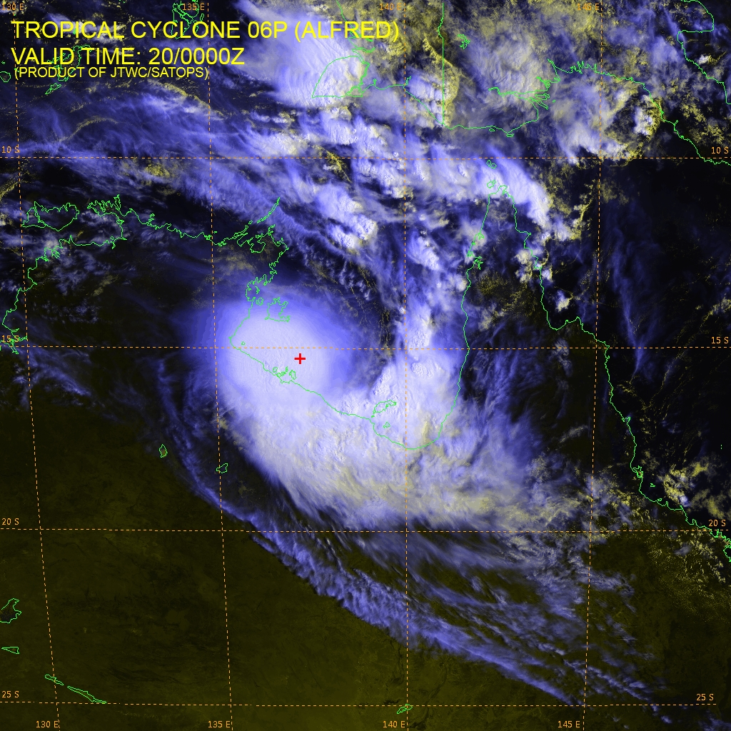
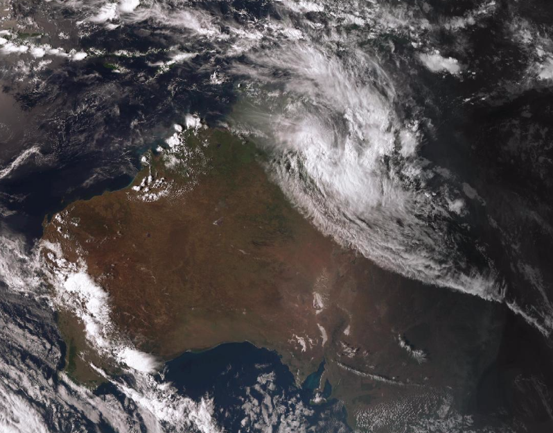
Tropical Cyclone "Alfred" at 00:00 UTC on February 20, 2017. Credit: JMA/Himawari, JTWC/SATOPS
Many catchments of the Carpentaria Coastal Rivers are saturated from monsoonal conditions over the past two weeks and are responding strongly to further rainfall. Road conditions have been affected in many areas and some roads remain impassable. Some communities may remain isolated until conditions improve, BOM said.
Affected population is urged to closely monitor the Bureau’s website for the latest information through local media and follow the advice of local emergency services.
Featured image: Tropical Cyclone "Alfred" at 09:50 UTC on February 20, 2017. Credit JMA/Himawari, BOM
Commenting rules and guidelines
We value the thoughts and opinions of our readers and welcome healthy discussions on our website. In order to maintain a respectful and positive community, we ask that all commenters follow these rules:
We reserve the right to remove any comments that violate these rules. By commenting on our website, you agree to abide by these guidelines. Thank you for helping to create a positive and welcoming environment for all.