Impressive quick clay landslide in St-Luc-de-Vincennes, Canada
An impressive quick clay landslide occurred in St-Luc-de-Vincennes, Quebec, Canada on November 10, 2016. Several homes were evacuated, although, luckily, no injuries were reported.
A massive portion of land fell into a stream that flows into the St. Lawrence River. According to media reports, the affected region is about 200 m (656.2 feet) wide. Several homes along the St-Joseph Row were evacuated.
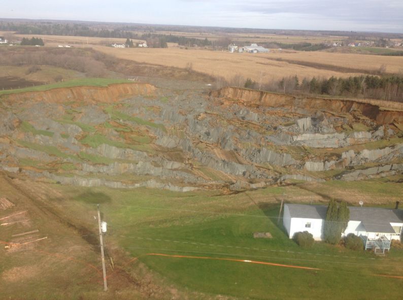
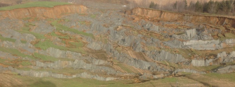
Large quick clay landslide in St-Luc-de-Vincennes, Quebec, November 10, 2016. Image credit: Elizabeth Laplante (via Twitter)
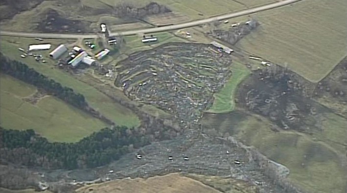
Large quick clay landslide in St-Luc-de-Vincennes, Quebec, November 10, 2016. Image credit: Xania News
According to Dave Petley of The Landslide Blog (AGU), the landslide shape, of a narrow outlet and large bowl, along with the high mobility of the wet, muddy debris, indicates it was likely a case of classic quick clay landslide. No instability signs in the field have been detected at the site in 2013, according to images taken by Google Earth.
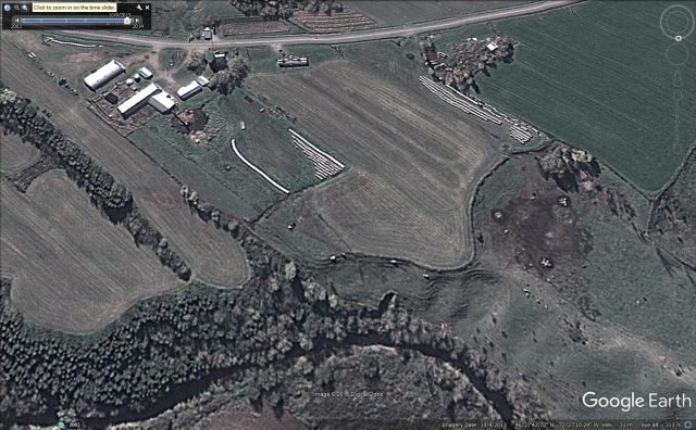
The site of the landslide at St-Luc-de-Vincennes, Quebec, Google Earth 2013 image. Image credit: Google Earth
However, the expert noticed an active landslide is present at the toe of the failure, where the debris has entered the stream. This suggests the landslide has retrogressed and then triggered the runaway quick clay landslide.
À St-Luc-de-Vincennes, la Sécurité civile installe clôtures de sécurité avant la nuit. 1 personne encore évacuée. #GlissementDeTerrain #MM pic.twitter.com/VvzywkPnb5
— Mireille Roberge (@MRoberge_MM) November 10, 2016
La sécurité civile fera le point à 14:30 à la suite du glissement de terrain à St-Luc-de-Vincennes. #MM pic.twitter.com/eNsJqasNFk
— Mireille Roberge (@MRoberge_MM) November 10, 2016
Featured image: Large quick clay landslide in St-Luc-de-Vincennes, Quebec, November 10, 2016. Image credit: Elizabeth Laplante (via Twitter)
Sometimes modern societies put rip rap along a river bank. Check out Skagit River Dike District 3 for successful examples. So sad for the homes and people that had to be needlessly evacuated! If only some simple planning and investment was done before the disaster occurred.
Is this a sinkhole? The land has sunk and it seems that the energy of this happening has forced a ‘slide’ out and into a natural waterway. If you compare the before and after pics, you can see where the sinking is that I am thinking off, and the push out to the waterway.