First eruption of Mount Sourbaya in 60 years continues, far South Atlantic Ocean
On April 24, 2016, satellite sensors detected a volcanic eruption at Bristol Island's Mount Sourbaya, far South Atlantic Ocean, between South America and Antarctica. It was Sourbaya's first detected eruption in the last 60 years. Imagery obtained one month later show that the eruption still continues.
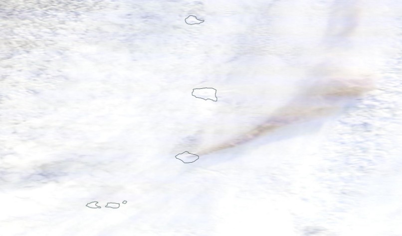
On May 28, 2016, the Moderate Resolution Imaging Spectroradiometer (MODIS) instrument on NASA’s Terra satellite acquired this natural-color image of a volcanic plume streaming northeast from Bristol Island. The plume casts a shadow on the sea ice below. Most of the white in the image is likely ice, rather than clouds.
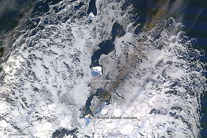
NASA image by Jeff Schmaltz, LANCE/EOSDIS Rapid Response. Caption by Mike Carlowicz. Acquired May 28, 2016.
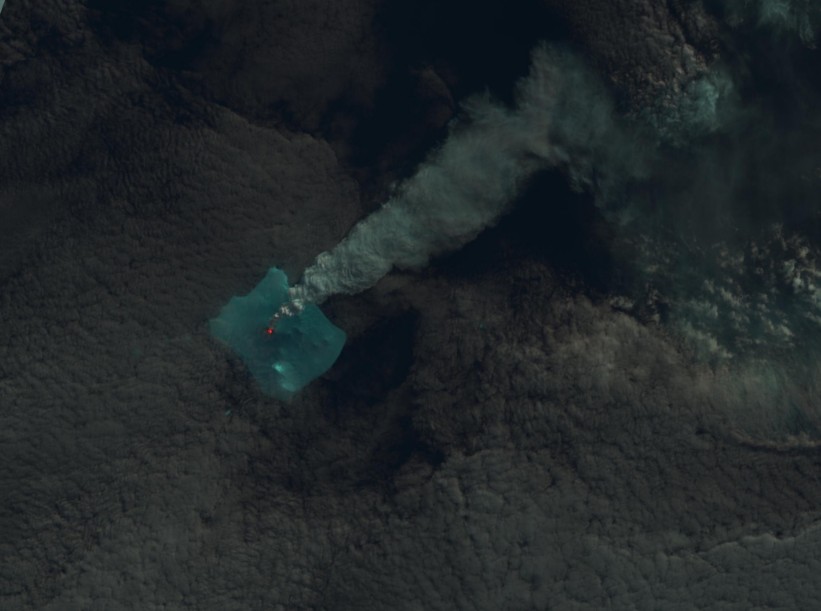
Bristol Island volcano erupting on May 31, 2016. Image credit: NASA/NOAA/DoD Suomi NPP / VIIRS
With a roughly rectangular shape that is 12 kilometers (7 miles) by 14 kilometers (8.5 miles), Bristol Island is one of the largest in the South Sandwich Islands chain. The highest peak on the island stands 1 100 meters (3 609 feet) above sea level.
Due to the remote location and the lack of landing sites amidst its ice cap, the stratovolcano on the island is one of the least studied in the world.
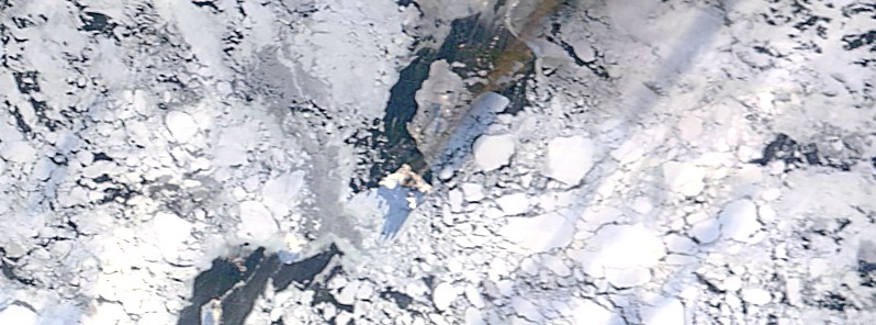
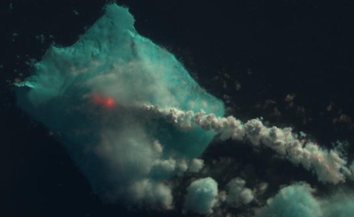
Bristol Island volcano erupting on April 24, 2016. Image credit: USGS LANDSAT-8/OLI
Bristol Island volcano erupting on May 1, 2016. Image credit: USGS LANDSAT-8/OLI
Images collected before April 24 show no similar signs of activity. However, it is possible the clouds have blocked the detection of infrared activity.
Geological summary
The 9 x 10 km (5.6 x 6.2 miles) Bristol Island near the southern end of the South Sandwich arc lies across Fortser's Passage from the Southern Thule Islands and forms one of the largest islands of the chain. Largely glacier-covered, it contains a horseshoe-shaped ridge at the interior extending northward from the highest peak, 1 100-m-high (3 609 feet) Mount Darnley.
A steep-sided flank cone or lava dome, Havfruen Peak, is located on the east side, and a young crater and fissure are on the west flank. Three large sea stacks lying off Turmoil Point at the western tip of the island may be remnants of an older now-eroded volcanic center. Both summit and flank vents have been active during historical time. The latest eruption, during 1956, originated from the west-flank crater, and deposited cinder over the icecap. The extensive ice cap and the difficulty of landing make it the least explored of the South Sandwich Islands. (GVP)
Featured image: NASA image by Jeff Schmaltz, LANCE/EOSDIS Rapid Response. Caption by Mike Carlowicz. Acquired May 28, 2016.
Commenting rules and guidelines
We value the thoughts and opinions of our readers and welcome healthy discussions on our website. In order to maintain a respectful and positive community, we ask that all commenters follow these rules:
We reserve the right to remove any comments that violate these rules. By commenting on our website, you agree to abide by these guidelines. Thank you for helping to create a positive and welcoming environment for all.