Typhoon “Dolphin” intensifies on its way toward Guam, extensive damage possible
"Dolphin" formed on May 7 south of Pohnpei in the western Pacific Ocean and reached typhoon status on March 13, 2015. Further intensification is expected on its way toward Guam.
There is a possibility of extensive damage either on Guam or somewhere within the Northern Marianas when the typhoon arrives on May 15.
"This could possibly be one of the biggest hits in the decade if it continues on its current track," Landon Aydlett, NWS meteorologist, said.
"Residents should definitely start putting up shutters, clear loose debris and foliage around homes before Friday," Department of Homeland Security spokeswoman Jenna Gaminde said. They should stock up on fuel, non-perishable foods and drinking water, and park cars in protected areas.
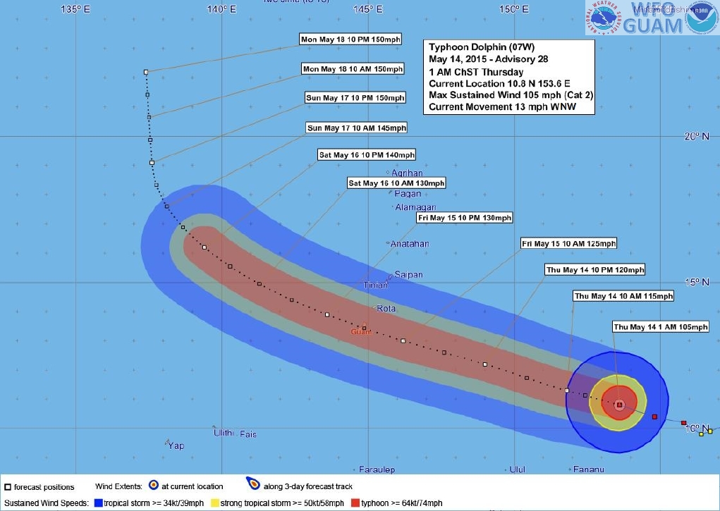
Typhoon "Dolphin" forecast track by NWS Guam on May 13, 2015.
NWS Guam issued a Typhoon Watch for Guam, Rota, Tinian and Saipan. Typhoon conditions, including winds of 119 km/h (74 mph) and greater are possible within 48 hours, the agency said in their 19:00 UTC update today.
A Tropical Storm Watch is in effect for Fananu in Chuuk State. Tropical storm conditions, including damaging winds of 62 – 117 km/h (39 to 73 mph) are possible within 24 hours.
At 15:00 UTC today, the eye of Typhoon "Dolphin" was located about 289 km (180 miles) NE of Fananu, about 1005 km (625 miles) ESE of Guam and 981 km (610 miles) ESE of Rota, Tinian and Saipan. Dolphin's intensity was 169 km/h (105 mph).
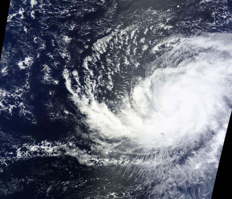
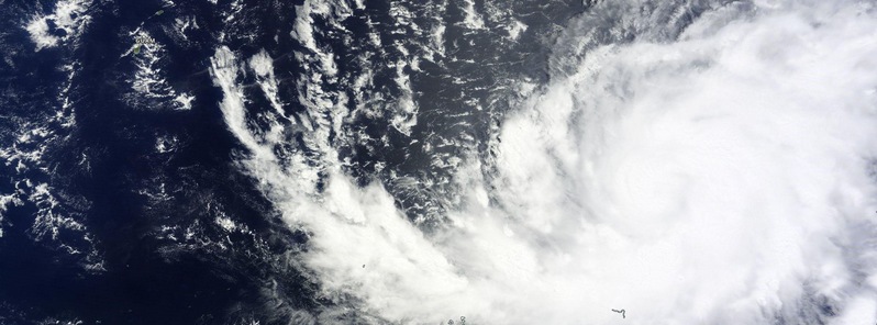
Typhoon "Dolphin" on May 13, 2015. Image credit: NASA Terra/MODIS.
NWS Guam noted it is still too early to provide exact wind and surge forecast values for specific locations. A general concern should be for the possibility of extensive damage either on Guam or somewhere within the Northern Marianas. For those under watch, now is the time to begin preparing your home or business according to your typhoon disaster plan.
Inter-island travel is not advised on Fananu and The Hall Islands until Dolphin passes well to the west.
Typhoon "Dolphin" forecast track by JTWC on May 13, 2015.
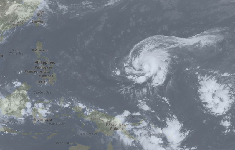
Image credit: UW-CIMSS/SSEC
Satellite animations
- Storm-Centered Infrared (MTSAT; NOAA/SSD)
- Storm-Centered Infrared (Aviation Color Enhancement) (MTSAT; NOAA/SSD)
- Storm-Centered Water Vapor (MTSAT; NOAA/SSD)
- Storm-Centered Visible (MTSAT; NOAA/SSD)
- Storm-Centered Visible (Colorized) (MTSAT; NOAA/SSD)
- Storm-Centered Infrared (MTSAT2; CIMSS)
- Storm-Centered Enhanced Infrared (MTSAT2; CIMSS)
- Storm-Centered Water Vapor (MTSAT2; CIMSS)
- Storm-Centered Visible (MTSAT2; CIMSS)
- Tropical West Pacific Infrared (MTSAT2; NOAA)
- Tropical West Pacific Enhanced Infrared (MTSAT2; NOAA)
- Tropical West Pacific Water Vapor (MTSAT2; NOAA)
- Tropical West Pacific Visible (MTSAT2; NOAA)
Featured image: Typhoon "Dolphin" on May 13, 2015. Credit: NASA/Terra MODIS.
At the time of the full moon – Wesak on 4th May, I had a vision of a submarine base in the Pacific ocean being destroyed by very large waves. This could be it . . . On my You Tube channel in April, I posted a video of visions impacting the south pacifc and othe parts of the planets. Some of your readers may be interested. I am an esoteric astrologer and spiritual healer from Australia. thanks for your wonderful work. https://youtu.be/AWnjBxT8FDI