Active volcanoes in the world: September 26 – October 02, 2012
New unrest has been noticed around 4 volcanoes, ongoing activity was reported for 9 volcanoes. This report covers active volcanoes in the world recorded from September 26 – October 2, 2012 based on Smithsonian/USGS criteria.
The Weekly Volcanic Activity Report is a cooperative project between the Smithsonian’s Global Volcanism Program and the US Geological Survey’s Volcano Hazards Program. Updated by 23:00 UTC every Wednesday, notices of volcanic activity posted on these pages are preliminary and subject to change as events are studied in more detail. This is not a comprehensive list of all of Earth’s volcanoes erupting during the week, but rather a summary of activity at volcanoes that meet criteria discussed in detail in the “Criteria and Disclaimers” section. Carefully reviewed, detailed reports on various volcanoes are published monthly in the Bulletin of the Global Volcanism Network.
New activity/unrest: | Havre Seamount, SW Pacific | Fuego, Guatemala | Marapi, Sumatra (Indonesia) |Tongariro, North Island (New Zealand)
Ongoing activity: | Bagana, Bougainville | Batu Tara, Komba Island (Indonesia) | Galeras, Colombia |Karymsky, Eastern Kamchatka (Russia) | Kilauea, Hawaii (USA) | Popocatépetl, México | Sakura-jima, Kyushu | Santa María, Guatemala | Shiveluch, Central Kamchatka (Russia)
New activity/unrest
HAVRE SEAMOUNT, Kermadec Islands (SW Pacific)
30.95°S, 179.13°W;
The GeoNet Data Centre reported that on 1 October a pilot observed floating pumice in the Kermadec Islands NE of New Zealand. The area of pumice started about 300 km W of Raoul Island and extended in a NE direction for about 600 km. The report speculated that the pumice was from the 18-19 July eruption of Havre Seamount and noted that there was no evidence that the volcano had erupted again.
Editor’s Note: Havre Seamount is not currently in the Global Volcanism Program’s database. The latitude and longitude in the header information come from the GNS report and may be updated at a later date, along with the summit elevation and Geologic summary.
FUEGO, Guatemala
14.473°N, 90.880°W; summit elev. 3763 m
INSIVUMEH reported that during 26-27 September explosions from Fuego ejected incandescent tephra 75-150 m above the crater, and produced ash plumes that rose 500-800 m and drifted 7 km N and NW. A hot lahar descended the Ceniza drainage (SSW), carrying logs, branches, and blocks over 1.5 m in diameter. During 29 September-2 October explosions ejected incandescent tephra 200 m above the crater and produced ash plumes that rose 500-1,100 m. Shock waves were detected in areas 12-15 km away. Incandescent avalanches traveled 700 m down the flanks; during 1-2 October avalanches traveled S down the Santa Teresa drainage. Ashfall was reported at the observatory, and in Morelia (8 km SW) and Santa Sofia (12 km SE).
Geologic summary: Volcán Fuego, one of Central America’s most active volcanoes, is one of three large stratovolcanoes overlooking Guatemala’s former capital, Antigua. The scarp of an older edifice, Meseta, lies between 3,763-m-high Fuego and its twin volcano to the N, Acatenango. Construction of Meseta volcano continued until the late Pleistocene or early Holocene, after which growth of the modern Fuego volcano continued the southward migration of volcanism that began at Acatenango. Frequent vigorous historical eruptions have been recorded at Fuego since the onset of the Spanish era in 1524, and have produced major ashfalls, along with occasional pyroclastic flows and lava flows. The last major explosive eruption from Fuego took place in 1974, producing spectacular pyroclastic flows visible from Antigua.
MARAPI, Sumatra (Indonesia)
0.381°S, 100.473°E; summit elev. 2891 m
According to news articles, an eruption from Marapi on 26 September produced an ash plume that rose 1.5 km above the crater.
Geologic summary: Gunung Marapi, not to be confused with the better known Merapi volcano on Java, is Sumatra’s most active volcano. Marapi is a massive complex stratovolcano that rises 2,000 m above the Bukittinggi plain in Sumatra’s Padang Highlands. A broad summit contains multiple partially overlapping summit craters constructed within the small 1.4-km-wide Bancah caldera. The summit craters are located along an ENE-WSW line, along which volcanism has migrated to the W. More than 50 eruptions, typically consisting of small-to-moderate explosive activity, have been recorded since the end of the 18th century; no historical lava flows outside the summit craters have been reported.
TONGARIRO, North Island (New Zealand)
39.13°S, 175.642°E; summit elev. 1978 m
The GeoNet Data Centre reported that researchers visited Tongariro’s Upper Te Mari Craters on 30 September to sample several of the fumaroles, conduct a carbon dioxide soil gas survey, collect ejecta from the 6-7 August eruption, and photograph the area. They found that the average carbon dioxide soil gas flux was lower than the 27 July measurements; 24 sites had increased fluxes while 20 had decreased. The estimated soil gas emission has decreased from about 5.8 to 2.5 tonnes per day based on these measurements.
Geologic summary: Tongariro is a large andesitic volcanic massif, located immediately NE of Ruapehu volcano, that is composed of more than a dozen composite cones constructed over a period of 275,000 years. Vents along a NE-trending zone extending from Saddle Cone (below Ruapehu volcano) to Te Mari crater (including vents at the present-day location of Ngauruhoe) were active during a several hundred year long period around 10,000 years ago, producing the largest known eruptions at the Tongariro complex during the Holocene. The youngest cone of the complex, Ngauruhoe, has grown to become the highest peak of the massif since its birth about 2500 years ago. The symmetrical, steep-sided Ngauruhoe, along with its neighbor Ruapehu to the south, have been New Zealand’s most active volcanoes during historical time.
Ongoing activity
BAGANA, Bougainville
6.140°S, 155.195°E; summit elev. 1750 m
Based on analyses of satellite imagery, the Darwin VAAC reported that on 27 September an ash plume from Bagana rose to an altitude of 2.4 km (8,000 ft) a.s.l. and drifted 37 km N.
Geologic summary: Bagana volcano, occupying a remote portion of central Bougainville Island, is one of Melanesia’s youngest and most active volcanoes. Bagana is a massive symmetrical lava cone largely constructed by an accumulation of viscous andesitic lava flows. The entire lava cone could have been constructed in about 300 years at its present rate of lava production. Eruptive activity at Bagana is characterized by non-explosive effusion of viscous lava that maintains a small lava dome in the summit crater, although explosive activity occasionally producing pyroclastic flows also occurs. Lava flows form dramatic, freshly preserved tongue-shaped lobes up to 50-m-thick with prominent levees that descend the volcano’s flanks on all sides.
BATU TARA, Komba Island (Indonesia)
7.792°S, 123.579°E; summit elev. 748 m
Based on analyses of satellite imagery, the Darwin Volcanic Ash Advisory Centre (VAAC) reported that during 26-28 September ash plumes from Batu Tara rose to an altitude of 2.4 km (8,000 ft) a.s.l. and drifted 18-37 km NW, W, and SW.
Geologic summary: The small isolated island of Batu Tara in the Flores Sea about 50 km north of Lembata (formerly Lomblen) Island contains a scarp on the eastern side similar to the Sciara del Fuoco of Italy’s Stromboli volcano. Vegetation covers the flanks of Batu Tara to within 50 m of the 748-m-high summit. Batu Tara lies north of the main volcanic arc and is noted for its potassic leucite-bearing basanitic and tephritic rocks. The first historical eruption from Batu Tara, during 1847-52, produced explosions and a lava flow.
GALERAS, Colombia
1.22°N, 77.37°W; summit elev. 4276 m
INGEOMINAS reported that during 25 September-2 October cameras around Galeras recorded emissions that were mostly water vapor drifting NW. However, on 27 and 28 September the emissions contained ash. An earthquake swarm detected on 28 September was characterized by M 1.4 events that occurred within 13 km of the crater at depths less than 8 km. The Alert Level remained at III (Yellow; “changes in the behavior of volcanic activity”).
Geologic summary: Galeras, a stratovolcano with a large breached caldera located immediately W of the city of Pasto, is one of Colombia’s most frequently active volcanoes. The dominantly andesitic Galeras volcanic complex has been active for more than 1 million years, and two major caldera collapse eruptions took place during the late Pleistocene. Longterm extensive hydrothermal alteration has affected the volcano. This has contributed to large-scale edifice collapse that has occurred on at least three occasions, producing debris avalanches that swept to the W and left a large horseshoe-shaped caldera inside which the modern cone has been constructed. Major explosive eruptions since the mid Holocene have produced widespread tephra deposits and pyroclastic flows that swept all but the southern flanks. A central cone slightly lower than the caldera rim has been the site of numerous small-to-moderate historical eruptions since the time of the Spanish conquistadors.
KARYMSKY, Eastern Kamchatka (Russia)
54.05°N, 159.45°E; summit elev. 1536 m
KVERT reported moderate seismic activity from Karymsky during 21-28 September. Seismic data indicated that ash plumes possibly rose to an altitude of 6 km (19,700 ft) a.s.l. Satellite imagery showed a thermal anomaly on the volcano during 23-25 September, and ash clouds near the volcano during 24-25 September. The Aviation Color Code remained at Orange.
Geologic summary: Karymsky, the most active volcano of Kamchatka’s eastern volcanic zone, is a symmetrical stratovolcano constructed within a 5-km-wide caldera that formed about 7,600-7,700 radiocarbon years ago. Construction of the Karymsky stratovolcano began about 2,000 years later. The latest eruptive period began about 500 years ago, following a 2,300-year quiescence. Much of the cone is mantled by lava flows less than 200 years old. Historical eruptions have been Vulcanian or Vulcanian-Strombolian with moderate explosive activity and occasional lava flows from the summit crater. Most seismicity preceding Karymsky eruptions has originated beneath Akademia Nauk caldera, which is located immediately S of Karymsky volcano and erupted simultaneously with Karymsky in 1996.
KILAUEA, Hawaii (USA)
19.421°N, 155.287°W; summit elev. 1222 m
During 26 September-2 October HVO reported that the circulating lava lake periodically rose and fell in the deep pit within Kilauea’s Halema’uma’u Crater. Periodic measurments indicated that the gas plume from the vent continued to deposit variable amounts of spatter and Pele’s hair onto nearby areas. Lava flows were active above the abandoned Royal Gardens subdivision and flowed down the pali. At Pu’u ‘O’o Crater, incandescence was often visible from the S pit, from lava circulating in the E pit, and from the W edge of the crusted N pit. An opening in the roof of the lava tube at the base of the SE flank of Pu’u ‘O’o also continued to glow.
Geologic summary: Kilauea, one of five coalescing volcanoes that comprise the island of Hawaii, is one of the world’s most active volcanoes. Eruptions at Kilauea originate primarily from the summit caldera or along one of the lengthy E and SW rift zones that extend from the caldera to the sea. About 90% of the surface of Kilauea is formed of lava flows less than about 1,100 years old; 70% of the volcano’s surface is younger than 600 years. A long-term eruption from the East rift zone that began in 1983 has produced lava flows covering more than 100 sq km, destroying nearly 200 houses and adding new coastline to the island.
POPOCATEPETL, México
19.023°N, 98.622°W; summit elev. 5426 m
CENAPRED reported that during 25 September-2 October seismicity at Popocatépetl indicated continuing gas-and-steam emissions; cloud cover often prevented visual observations of the volcano. Incandescence from the crater was sometimes observed at night. On most days gas-and-steam plumes rose at most 1.5 km above the crater and drifted in multiple directions. The Alert Level remained at Yellow, Phase Two.
Geologic summary: Popocatépetl, whose name is the Aztec word for smoking mountain, towers to 5,426 m 70 km SE of Mexico City and is North America’s second-highest volcano. Frequent historical eruptions have been recorded since the beginning of the Spanish colonial era. A small eruption on 21 December 1994 ended five decades of quiescence. Since 1996 small lava domes have incrementally been constructed within the summit crater and destroyed by explosive eruptions. Intermittent small-to-moderate gas-and-ash eruptions have continued, occasionally producing ashfall in neighboring towns and villages.
SAKURA-JIMA, Kyushu
31.585°N, 130.657°E; summit elev. 1117 m
JMA reported that during 24-28 September explosions from Sakura-jima’s Showa Crater ejected tephra as far as 1.8 km from the crater. Based on information from JMA, the Tokyo VAAC reported that explosions during 26 September-2 October often produced plumes that rose to altitudes of 1.8-3.4 km (6,000-11,000 ft) a.s.l. and drifted W, S, SE, and E. During 26-27 September pilots observed ash plumes that rose to altitudes of 1.2-3.4 km (4,000-11,000 ft) a.s.l. and drifted SE.
Geologic summary: Sakura-jima, one of Japan’s most active volcanoes, is a post-caldera cone of the Airacaldera at the northern half of Kagoshima Bay. Eruption of the voluminous Ito pyroclastic flow was associated with the formation of the 17 x 23-km-wide Aira caldera about 22,000 years ago. The construction of Sakura-jima began about 13,000 years ago and built an island that was finally joined to the Osumi Peninsula during the major explosive and effusive eruption of 1914. Activity at the Kita-dake summit cone ended about 4,850 years ago, after which eruptions took place at Minami-dake. Frequent historical eruptions, recorded since the 8th century, have deposited ash on Kagoshima, one of Kyushu’s largest cities, located across Kagoshima Bay only 8 km from the summit. The largest historical eruption took place during 1471-76.
SANTA MARIA, Guatemala
14.756°N, 91.552°W; summit elev. 3772 m
INSIVUMEH reported that during 29 September-1 October explosions from Santa María’s Caliente dome generated ash plumes that rose 600-800 m and drifted W and SW. Active lava flows generated block avalanches that traveled S down the Rio Nima I and Rio Nima II during 29 September-2 October.
Geologic summary: Symmetrical, forest-covered Santa María volcano is one of a chain of large stratovolcanoes that rises dramatically above the Pacific coastal plain of Guatemala. The stratovolcano has a sharp-topped, conical profile that is cut on the SW flank by a large, 1-km-wide crater, which formed during a catastrophic eruption in 1902 and extends from just below the summit to the lower flank. The renowned Plinian eruption of 1902 followed a long repose period and devastated much of SW Guatemala. The large dacitic Santiaguito lava-dome complex has been growing at the base of the 1902 crater since 1922. Compound dome growth at Santiaguito has occurred episodically from four westward-younging vents, accompanied by almost continuous minor explosions and periodic lava extrusion, larger explosions, pyroclastic flows, and lahars.
SHIVELUCH, Central Kamchatka (Russia)
56.653°N, 161.360°E; summit elev. 3283 m
Based on visual observations and analyses of satellite data, KVERT reported that during 21-28 September a viscous lava flow continued to effuse on the NW flank of Shiveluch’s lava dome, accompanied by hot avalanches and fumarolic activity. Satellite imagery showed a thermal anomaly on the lava dome on 21, 23, and 27 September. The Aviation Color Code remained at Orange.
Geologic summary: The high, isolated massif of Shiveluch volcano (also spelled Sheveluch) rises above the lowlands NNE of the Kliuchevskaya volcano group and forms one of Kamchatka’s largest and most active volcanoes. The currently active Molodoy Shiveluch lava-dome complex was constructed during the Holocene within a large breached caldera formed by collapse of the massive late-Pleistocene Strary Shiveluch volcano. At least 60 large eruptions of Shiveluch have occurred during the Holocene, making it the most vigorous andesitic volcano of the Kuril-Kamchatka arc. Frequent collapses of lava-dome complexes, most recently in 1964, have produced large debris avalanches whose deposits cover much of the floor of the breached caldera. Intermittent explosive eruptions began in the 1990s from a new lava dome that began growing in 1980. The largest historical eruptions from Shiveluch occurred in 1854 and 1964.
Source: Global Volcanism Program
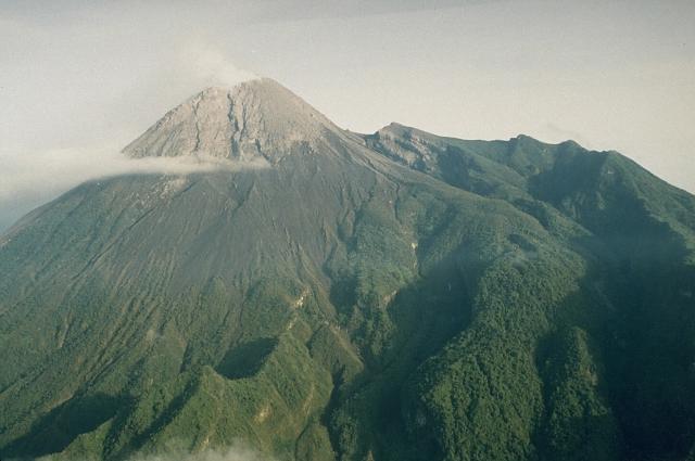
Featured image: Merapi stratovolcano, Indonesia. Photo by Yustinus Sulistiyo, 1994 (Volcanological Survey of Indonesia).
I think active volcanos are cool but can be deadly we have been learning a bought how they work its pretty cool
I think active volcanos are cool but can be deadly we have been learning a bought how they work its pretty cool
[…] Active volcanoes in the world: September 26 – October 02, 2012 New unrest has been noticed around 4 volcanoes, ongoing activity… […]