Tropical storm path plot shows Louisiana and Mississippi more prone to hurricane activity than other states
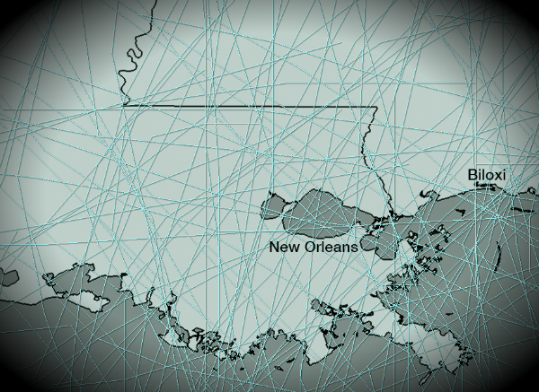
Hurricane Isaac and Hurricane Katrina made landfall on almost the same day on the same location, with 7 year difference. Some areas of US are just more prone to hurricane activity than others. Especially, Louisiana and Mississippi.

Here are plotted the paths of the 140 tropical cyclones – from Tropical Depression to Category 5 Hurricane – that have passed the states of Louisiana and Mississippi from 1850 until 2011 provided by NOAA Coastal Services Center.
View more: Historical Hurricane Tracks
[…] Tropical storm path plot shows Louisiana and Mississippi more prone to hurricane activity than other… Hurricane Isaac and Hurricane Katrina made landfall on almost the… […]
[…] via The Watchers – Tropical storm path plot shows Louisiana and Mississippi more prone to hurrican…. […]
[…] https://watchers.news/2012/09/09/tropical-storm-path-plot/ Share this:TwitterFacebookLike this:LikeBe the first to like this. […]