Active volcanoes in the world: May 30 – June 5, 2012
This report covers active volcanoes recorded from May 30 – June 5, 2012 based on Smithsonian/USGS criteria. New unrest has been noticed around 4 volcanoes, ongoing activity was reported for 12 volcanoes.
FUEGO, Guatemala
14.473°N, 90.880°W; summit elev. 3763 m
INSIVUMEH reported that on 1 June hot lahars traveled SE down Fuego’s Las Lajas and El Jute drainages carryingblocks 2 m in diameter. During 3-5 June explosions produced ash plumes that rose 500-1,000 m above the crater and drifted W and S. Pulses of incandescence from the crater was observed as well as avalanches on the W flank.Lava flows traveled 700 m down Taniluyá Canyon drainage and 1 km down Las Lajas. During 4-5 June seismicity increased and the lava flow in Las Lajas reached 1.2 km long. Explosions produced ash plumes that rose 600-800 m above the crater and drifted 7 km SW. Shock waves were detected up to 7 km away.
Geologic summary: Volcán Fuego, one of Central America’s most active volcanoes, is one of three largestratovolcanoes overlooking Guatemala’s former capital, Antigua. The scarp of an older edifice, Meseta, lies between 3,763-m-high Fuego and its twin volcano to the N, Acatenango. Construction of Meseta volcano continued until the late Pleistocene or early Holocene, after which growth of the modern Fuego volcano continued the southward migration of volcanism that began at Acatenango. Frequent vigorous historical eruptions have been recorded at Fuego since the onset of the Spanish era in 1524, and have produced major ashfalls, along with occasional pyroclastic flows and lava flows. The last major explosive eruption from Fuego took place in 1974, producing spectacular pyroclastic flows visible from Antigua.
GALERAS, Colombia
1.22°N, 77.37°W; summit elev. 4276 m
INGEOMINAS reported that on 17 May ash emissions originating from an area N and W of the cone within Galeras’s main crater rose 200 m above the crater rim. During 26-27 May ash plumes rose 800 m above the crater; ashfall was reported in Sandona (13 km NW). Ash emissions occurred on 2 June, and on 5 June plumes rose 1 km and drifted W. The Alert Level remained at III (Yellow; “changes in the behavior of volcanic activity”).
Geologic summary: Galeras, a stratovolcano with a large breached caldera located immediately W of the city of Pasto, is one of Colombia’s most frequently active volcanoes. The dominantly andesitic Galeras volcanic complex has been active for more than 1 million years, and two major caldera collapse eruptions took place during the late Pleistocene. Longterm extensive hydrothermal alteration has affected the volcano. This has contributed to large-scale edifice collapse that has occurred on at least three occasions, producing debris avalanches that swept to the W and left a large horseshoe-shaped caldera inside which the modern cone has been constructed. Major explosive eruptions since the mid Holocene have produced widespread tephra deposits and pyroclastic flows that swept all but the southern flanks. A central cone slightly lower than the caldera rim has been the site of numerous small-to-moderate historical eruptions since the time of the Spanish conquistadors.
MANAM, Northeast of New Guinea (SW Pacific)
4.080°S, 145.037°E; summit elev. 1807 m
RVO reported mild activity from Manam’s Southern Crater during the first two weeks of May. Emissions consisted of diffuse white vapor, with diffuse blue plumes observed during 5-6 and 13-14 May. Gray and gray-brown ash clouds rose from the crater on 7, 9, and 12 May. Incandescence was visible at night during 6, 8, 10-11, and 13-14 May, and incandescent tephra was occasionally ejected from the crater.
Activity increased on 16 May, marked by a change in emissions from gray and gray-brown ash clouds to gray-to-black ash clouds, and an increase in ejected incandescent tephra. On 27 and 30 May Strombolian activity was observed, and for periods lasting 1-2 hours incandescent tephra was continuously ejected from the crater. On 30 May two vents in Southern Crater produced lava fountains. Rumbling was heard, and ash plumes rose 100-400 m above the crater and drifted NW. Most of the ejected tephra fell back into the crater but some was channeled into the SE and SW valleys. Emissions from Main Crater were milder and mostly characterized by white plumes. Gray-to-gray-brown ash plumes were noted during 6, 10-11, 13, 26, 28-29, and 31 May. Fluctuating incandescence was intermittently observed. Ash fell in the NW part of the island.
Geologic summary: The 10-km-wide island of Manam, lying 13 km off the northern coast of mainland Papua New Guinea, is one of the country’s most active volcanoes. Four large radial valleys extend from the unvegetated summit of the conical 1807-m-high basaltic-andesitic stratovolcano to its lower flanks. These “avalanche valleys,” regularly spaced 90 degrees apart, channel lava flows and pyroclastic avalanches that have sometimes reached the coast. Two summit craters are present; both are active, although most historical eruptions have originated from the southern crater, concentrating eruptive products during much of the past century into the SE avalanche valley. Frequent historical eruptions, typically of mild-to-moderate scale, have been recorded at Manam since 1616. Occasional larger eruptions have produced pyroclastic flows and lava flows that reached flat-lying coastal areas and entered the sea, sometimes impacting populated areas.
NEVADO DEL RUIZ, Colombia
4.895°N, 75.322°W; summit elev. 5321 m
According to INGEOMINAS, the Observatorio Vulcanológico and Sismológico de Manizales reported that on 4 June observations of Nevado del Ruiz during an overflight and through web cameras located in the vicinity of Arenas Crater revealed that gas-and-ash plumes rose at most 1 km above the crater and drifted W and NW. The next day seismic signals indicated that ash emissions continued. Field observers noted that sulfur dioxide emissions were significant. Based on analysis of satellite imagery, the Washington VAAC reported that an ash plume drifted 40 km W. The VAAC also noted that the Bogota MWO reported ash emissions drifting NNW at an altitude of 9.1 km (30,000 ft) a.s.l. The Alert Level remained at II (Orange; “eruption likely within days or weeks”).
Geologic summary: Nevado del Ruiz is a broad, glacier-covered volcano in central Colombia that covers >200 sq km. Three major edifices, composed of andesitic and dacitic lavas and andesitic pyroclastics, have been constructed since the beginning of the Pleistocene. The modern cone consists of a broad cluster of lava domes built within the summit caldera of an older Ruiz volcano. The 1-km-wide, 240-m-deep Arenas crater occupies the summit. Steep headwalls of massive landslides cut the flanks of Nevado del Ruiz. Melting of its summit icecap during historical eruptions, which date back to the 16th century, has resulted in devastating lahars, including one in 1985 that was South America’s deadliest eruption.
Ongoing activity
BATU TARA, Komba Island (Indonesia)
7.792°S, 123.579°E; summit elev. 748 m
Based on analyses of satellite imagery, the Darwin VAAC reported that during 2-5 June ash plumes from Batu Tara rose to an altitude of 1.8 km (6,000 ft) a.s.l. and drifted 37-110 km NW.
Geologic summary: The small isolated island of Batu Tara in the Flores Sea about 50 km north of Lembata (formerly Lomblen) Island contains a scarp on the eastern side similar to the Sciara del Fuoco of Italy’s Stromboli volcano. Vegetation covers the flanks of Batu Tara to within 50 m of the 748-m-high summit. Batu Tara lies north of the main volcanic arc and is noted for its potassic leucite-bearing basanitic and tephritic rocks. The first historical eruption from Batu Tara, during 1847-52, produced explosions and a lava flow.
CLEVELAND, Chuginadak Island
52.825°N, 169.944°W; summit elev. 1730 m
On 30 May AVO reported that no explosions or renewed lava-dome growth had been detected at Cleveland since 9 May. The Volcano Alert Level was lowered to Advisory and the Aviation Color Code was lowered to Yellow. On 4 June a possible small explosion was detected by infrasound. No eruption plume was observed in cloudy satellite images, but elevated surface temperatures were detected at the summit.
Geologic summary: Symmetrical Mount Cleveland stratovolcano is situated at the western end of the uninhabited dumbbell-shaped Chuginadak Island in the east-central Aleutians. The 1,730-m-high stratovolcano is the highest of the Islands of Four Mountains group and is one of the most active in the Aleutians. Numerous large lava flows descend its flanks. It is possible that some 18th to 19th century eruptions attributed to Carlisle (a volcano located across the Carlisle Pass Strait to the NW) should be ascribed to Cleveland. In 1944 Cleveland produced the only known fatality from an Aleutian eruption. Recent eruptions from Mt. Cleveland have been characterized by short-lived explosive ash emissions, at times accompanied by lava fountaining and lava flows down the flanks.
KARYMSKY, Eastern Kamchatka (Russia)
54.05°N, 159.45°E; summit elev. 1536 m
KVERT reported that moderate seismic activity from Karymsky continued to be detected during 25 May-1 June. Satellite imagery showed a thermal anomaly on the volcano during 25, 28, and 30-31 May. The Aviation Color Coderemained at Orange.
Geologic summary: Karymsky, the most active volcano of Kamchatka’s eastern volcanic zone, is a symmetricalstratovolcano constructed within a 5-km-wide caldera that formed about 7,600-7,700 radiocarbon years ago. Construction of the Karymsky stratovolcano began about 2,000 years later. The latest eruptive period began about 500 years ago, following a 2,300-year quiescence. Much of the cone is mantled by lava flows less than 200 years old. Historical eruptions have been Vulcanian or Vulcanian-Strombolian with moderate explosive activity and occasional lava flows from the summit crater. Most seismicity preceding Karymsky eruptions has originated beneath Akademia Nauk caldera, which is located immediately S of Karymsky volcano and erupted simultaneously with Karymsky in 1996.
KILAUEA, Hawaii (USA)
19.421°N, 155.287°W; summit elev. 1222 m
During 30 May-5 June HVO reported that the circulating and spattering lava lake periodically rose and fell in the deep pit within Kilauea’s Halema’uma’u Crater, rising as high as the inner ledge about 60 m below the crater floor. Periodic measurements indicated that the gas plume from the vent continued to deposit variable amounts of ashand Pele’s hair onto nearby areas. The level of the lava pond in a small pit on the E edge of Pu’u ‘O’o crater floor rose back into view. Field geologists observed many lava flows coming down the pali and extending onto the coastal plain. A small new collapse pit in Pu’u ‘O’o about 50 m west of the southern spatter cone was observed on 1 June; weak incandescence from this pit was visible in the thermal camera. On 5 June geologists observed a second small collapse pit near the south-central edge that had been covered by a small shield of lava while the lava pond in the E collapse pit had risen to within about 5 m of the rim.
Geologic summary: Kilauea, one of five coalescing volcanoes that comprise the island of Hawaii, is one of the world’s most active volcanoes. Eruptions at Kilauea originate primarily from the summit caldera or along one of the lengthy E and SW rift zones that extend from the caldera to the sea. About 90% of the surface of Kilauea is formed of lava flows less than about 1,100 years old; 70% of the volcano’s surface is younger than 600 years. A long-term eruption from the East rift zone that began in 1983 has produced lava flows covering more than 100 sq km, destroying nearly 200 houses and adding new coastline to the island.
POPOCATEPETL, México
19.023°N, 98.622°W; summit elev. 5426 m
CENAPRED reported that during 30 May-5 June gas-and-ash plumes from Popocatépetl rose as high as 2 km above the crater and drifted mostly W and SW, but also NW and ENE. Cloud cover occasionally prevented observations of the plumes and crater. Incandescence from the crater was visible on most nights. Incandescent fragments were ejected from the crater on 5 June. The Alert Level remained at Yellow Phase Three.
Geologic summary: Popocatépetl, whose name is the Aztec word for smoking mountain, towers to 5,426 m 70 km SE of Mexico City and is North America’s second-highest volcano. Frequent historical eruptions have been recorded since the beginning of the Spanish colonial era. A small eruption on 21 December 1994 ended five decades of quiescence. Since 1996 small lava domes have incrementally been constructed within the summit crater and destroyed by explosive eruptions. Intermittent small-to-moderate gas-and-ash eruptions have continued, occasionally producing ashfall in neighboring towns and villages.
RABAUL, New Britain
4.271°S, 152.203°E; summit elev. 688 m
RVO reported that observations of Rabaul caldera’s Tavurvur cone during 1-31 May revealed some periods of white emissions. Seismic activity was very low; however, several high-frequency volcano-tectonic earthquakes were recorded.
Geologic summary: The low-lying Rabaul caldera on the tip of the Gazelle Peninsula at the NE end of New Britain forms a broad sheltered harbor. The outer flanks of the 688-m-high asymmetrical pyroclastic shield volcano are formed by thick pyroclastic-flow deposits. The 8 x 14 km caldera is widely breached on the E, where its floor is flooded by Blanche Bay. Two major Holocene caldera-forming eruptions at Rabaul took place as recently as 3,500 and 1,400 years ago. Three small stratovolcanoes lie outside the northern and NE caldera rims. Post-caldera eruptions built basaltic-to-dacitic pyroclastic cones on the caldera floor near the NE and western caldera walls. Several of these, including Vulcan cone, which was formed during a large eruption in 1878, have produced major explosive activity during historical time. A powerful explosive eruption in 1994 occurred simultaneously from Vulcan and Tavurvur volcanoes and forced the temporary abandonment of Rabaul city.
SAKURA-JIMA, Kyushu
31.585°N, 130.657°E; summit elev. 1117 m
JMA reported that during 1-4 June seven explosions from Sakura-jima’s Showa Crater ejected ballistics 800-1,300 m from the crater. Based on information from JMA, the Tokyo VAAC reported that during 30 May-5 June explosions produced plumes that rose to altitudes of 1.2-3 km (4,000-10,000 ft) a.s.l. and drifted SW, W, and NW. Pilots observed ash plumes during 3-4 June that rose to altitudes of 2.7-3.4 (9,000-11,000 ft) a.s.l. and drifted W.
Geologic summary: Sakura-jima, one of Japan’s most active volcanoes, is a post-caldera cone of the Aira calderaat the northern half of Kagoshima Bay. Eruption of the voluminous Ito pyroclastic flow was associated with the formation of the 17 x 23-km-wide Aira caldera about 22,000 years ago. The construction of Sakura-jima began about 13,000 years ago and built an island that was finally joined to the Osumi Peninsula during the major explosive and effusive eruption of 1914. Activity at the Kita-dake summit cone ended about 4,850 years ago, after which eruptions took place at Minami-dake. Frequent historical eruptions, recorded since the 8th century, have depositedash on Kagoshima, one of Kyushu’s largest cities, located across Kagoshima Bay only 8 km from the summit. The largest historical eruption took place during 1471-76.
SANGAY, Ecuador
2.002°S, 78.341°W; summit elev. 5230 m
According to the Washington VAAC, a pilot observed an ash plume from Sangay on 4 June that rose to an altitude of 7.9 km (26,000 ft) a.s.l. and drifted E. Ash was not detected in satellite imagery.
Geologic summary: The isolated Sangay volcano, located E of the Andean crest, is the southernmost of Ecuador’s volcanoes, and its most active. It has been in frequent eruption for the past several centuries. The steep-sided, 5,230-m-high glacier-covered volcano grew within horseshoe-shaped calderas of two previous edifices, which were destroyed by collapse to the E, producing large debris avalanches that reached the Amazonian lowlands. The modern edifice dates back to at least 14,000 years ago. Sangay towers above the tropical jungle on the E side; on the other sides flat plains of ash from the volcano have been sculpted by heavy rains into steep-walled canyons up to 600 m deep. The earliest report of an historical eruption was in 1628. More or less continuous eruptions were reported from 1728 until 1916, and again from 1934 to the present. The more or less constant eruptive activity has caused frequent changes to the morphology of the summit crater complex.
SHIVELUCH, Central Kamchatka (Russia)
56.653°N, 161.360°E; summit elev. 3283 m
KVERT reported that during 25 May-1 June explosive activity at Shiveluch continued. Ground-based observers and satellite imagery indicated that a viscous lava flow continued to effuse in the active crater, and was accompanied byfumarolic activity and lava-dome incandescence. Observers noted that ash plumes rose to an altitude of 9 km (29,500 ft) a.s.l. on 25 and 27 May, and to an altitude of 6 km (19,700 ft) a.s.l. during 29-30 May. Satellite imagery showed ash plumes drifting 555 km SW, SE, and E during 25-30 May, and a thermal anomaly over the lava domeduring 26-29 May. The Aviation Color Code remained at Orange.
Based on analyses of satellite images, the Tokyo VAAC reported that a possible eruption on 2 June produced anash plume that rose to an altitude of 9.1 km (30,000 ft) a.s.l. and drifted S. Subsequent images during 2-3 June showed ash.
Geologic summary: The high, isolated massif of Shiveluch volcano (also spelled Sheveluch) rises above the lowlands NNE of the Kliuchevskaya volcano group and forms one of Kamchatka’s largest and most active volcanoes. The currently active Molodoy Shiveluch lava-dome complex was constructed during the Holocene within a large breached caldera formed by collapse of the massive late-Pleistocene Strary Shiveluch volcano. At least 60 large eruptions of Shiveluch have occurred during the Holocene, making it the most vigorous andesitic volcano of the Kuril-Kamchatka arc. Frequent collapses of lava-dome complexes, most recently in 1964, have produced large debris avalanches whose deposits cover much of the floor of the breached caldera. Intermittent explosive eruptions began in the 1990s from a new lava dome that began growing in 1980. The largest historical eruptions from Shiveluch occurred in 1854 and 1964.
TUNGURAHUA, Ecuador
1.467°S, 78.442°W; summit elev. 5023 m
IG reported that during 30 May-5 June visual observations of Tungurahua were sometimes limited due to cloud cover. On 30 May gas-and-ash plumes rose from the crater and ash fell on the upper flanks. The next day gas-and-ash plumes rose 200 m above the crater and drifted W. On 3 June gas-and-ash plumes rose 100 m above the crater and an ash plume drifted NW. Lahars descended multiple drainages on the W flank. On 5 June ashfall was reported in Pondoa (8 km N), Juive (7 km NNW), Runtún (6 km NNE), Chacauco (NW), and Chontapamba (W), and steam emissions rose 1 km above the crater and drifted E.
Geologic summary: The steep-sided Tungurahua stratovolcano towers more than 3 km above its northern base. It sits ~140 km S of Quito, Ecuador’s capital city, and is one of Ecuador’s most active volcanoes. Historical eruptions have all originated from the summit crater. They have been accompanied by strong explosions and sometimes bypyroclastic flows and lava flows that reached populated areas at the volcano’s base. The last major eruption took place from 1916 to 1918, although minor activity continued until 1925. The latest eruption began in October 1999 and prompted temporary evacuation of the town of Baños on the N side of the volcano.
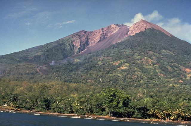
ULAWUN, New Britain
5.05°S, 151.33°E; summit elev. 2334 m
RVO reported that during 1-6 and 10-26 May white plumes rose above Ulawun’s summit crater, and during 7-9 and 27-31 May gray-brown ash plumes rose from the crater.
Geologic summary: The symmetrical basaltic to andesitic Ulawun stratovolcano is the highest volcano of the Bismarck arc, and one of Papua New Guinea’s most frequently active. Ulawun rises above the N coast of New Britain opposite Bamus volcano. The upper 1,000 m of the 2,334-m-high volcano is unvegetated. A steep-walled valley cuts the NW side of the volcano, and a flank lava-flow complex lies to the S of this valley. Historical eruptions date back to the beginning of the 18th century. Twentieth-century eruptions were mildly explosive until 1967, but after 1970 several larger eruptions produced lava flows and basaltic pyroclastic flows, greatly modifying the summit crater.
Source: Global Volcanism Program
Featured image: Wally Johnson (Australia Bureau of Mineral Resources)
[…] Active volcanoes in the world: May 30 – June 5, 2012 This report covers active volcanoes recorded from May 30 –… […]
Thank you, good report. I’ve been studying this all year. Love that you guys are on it! I have a theory – been wondering if the volcanic activity has something to do with earths magnetic core , changing due to Solar flares.
[…] on thewatchers.adorraeli.com Share this:TwitterFacebookLike this:LikeBe the first to like this post. This entry was posted in […]