Strong earthquake struck New Ireland Region, Papua New Guinea
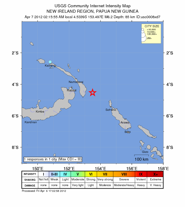
Magnitude 6.2 earthquake struck New Ireland Region of Papua New Guinea on April 6, 2012 at 16:15:55 UTC according to USGS. The epicenter was located 150 km (93 miles) ESE (104°) from Rabaul, New Britain, PNG (4.534°S, 153.497°E). The depth of epicenter was at 85.4 km (53.1 miles).
No tsunami alert was issued.
Epicenter was out in the sea and at a depth so no damage is expected.
Papua New Guinea is often struck by massive earthquakes with magnitudes of 7 or more.
| Magnitude | 6.2 |
|---|---|
| Date-Time |
|
| Location | 4.534°S, 153.497°E |
| Depth | 85.4 km (53.1 miles) |
| Region | NEW IRELAND REGION, PAPUA NEW GUINEA |
| Distances |
|
| Location Uncertainty | horizontal +/- 14.3 km (8.9 miles); depth +/- 9.5 km (5.9 miles) |
| Parameters | NST=247, Nph=247, Dmin=152.5 km, Rmss=1 sec, Gp= 18°, M-type=regional moment magnitude (Mw), Version=9 |
| Source |
|
| Event ID | usc0008xd7 |

Probably not the best place for this info, but it is a regional/global event.
FLASH: Indonesia’s geophysical agency says earthquake of 8.9 on Richter scale off Aceh, issues tsunami warning
ETA: USGS has it at 8.7
http://earthquake.usgs.gov/earthquakes/recenteqsww/Quakes/usc000905e.html
ETA2:
Tremors from Indonesia quake felt in Singapore, Thailand and southern India – Reuters witnesses