Major M7.7 earthquake hits Aleutian Trench, tsunami advisories issued

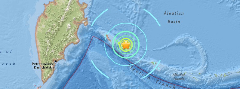
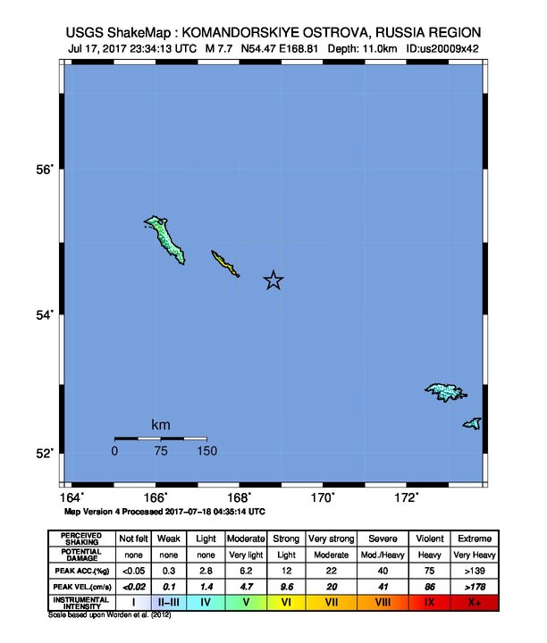
A major earthquake registered by the USGS as M7.7 hit near Komandorskiye Ostrova, Russia at 23:34 UTC on July 17, 2017. The agency is reporting a shallow depth of 11 km (6.8 miles.) This is the 4th earthquake in this area since M6.2 at 11:05 UTC today. It was followed by M5.2 at 23:49 UTC, M5.1 at 23:52, M5.2 at 23:57 UTC on July 17 and M5.3 at 00:26 UTC on July 18, according to the USGS.
GFZ Potsdam (GEOFON Program) is reporting the 23:34 UTC quake as M7.7 at a depth of 10 km (6.2 miles). For the 23:57 UTC quake, they initially reported another major earthquake measuring M8.0 (automatic, non-revised), and later downgraded it to M5.4. USGS reports that one as M5.2.
According to the USGS, the epicenter of today’s M7.7 earthquake was located 335.5 km (208.5 miles) WNW of Attu (population 0), Alaska and 547.7 km (340.3 miles) ESE of Klyuchi (population 10 000), Russia.
There are no people living within 100 km (62 miles). However, based on all available data, hazardous tsunami waves are forecast for some coasts.
A tsunami advisory is currently in effect for Aleutian Islands, Samalaga Pass, Alaska to Attu, Alaska including the Pribilof Islands, NTWC said.
According to PTWC’s Tsunami Threat Message issued 00:14 UTC on July 18, tsunami waves are forecast to be less than 0.3 m (0.98 feet) above the tide level for the coasts of Guam, Hawaii, Japan, Johnston Atoll, Marshall Islands, Midway Island; Northern Marianas, Northwestern Hawaiian Islands, Russia, Wake Island, and Yap.
At 01:00 UTC, PTWC issued their FInal Tsunami Threat Message, saying that the tsunami threat from this earthquake has now passed.

According to TASS, Russian News Agency, the Kamchatka crisis management center of the Russian Ministry for Emergency Situations said the tsunami wave forecasted at 50 cm (19.7 inches) in height has failed to approach Kamchatka’s Bering Island. Teams of specialists are examining buildings after major aftershocks, but no destruction has been fixed as of yet.
Meanwhile, according to the head of Kamchatka’s Aleutian district, Svetlana Arnatskaya, strong tremors were felt. “Suspended items were swinging back and forth, items were tumbling off shelves. There has been no destruction,” she said, adding that teams of specialists continue examining the area for possible destruction.
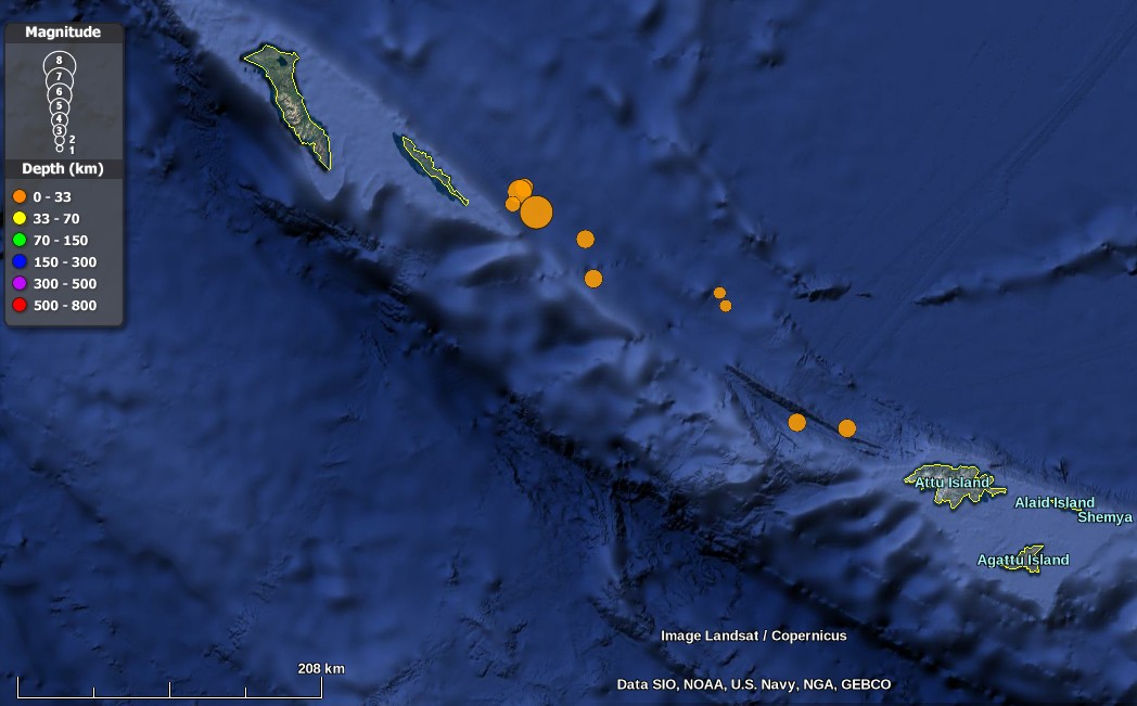
The map below shows all earthquakes in this region registered by the USGS between 11:05 UTC on July 17 and 00:26 UTC on July 18.

Credit: USGS, Landsat/Copernicus, Google
-
5.3
252km ESE of Nikol’skoye, Russia
2017-07-18 00:26:24 (UTC)
-
5.2
127km WNW of Attu Station, Alaska
2017-07-17 23:57:43 (UTC)
-
5.1
95km WNW of Attu Station, Alaska
2017-07-17 23:52:49 (UTC)
-
5.2
235km ESE of Nikol’skoye, Russia
2017-07-17 23:49:29 (UTC)
-
7.7
199km ESE of Nikol’skoye, Russia
2017-07-17 23:34:14 (UTC)
-
4.4
183km ESE of Nikol’skoye, Russia
2017-07-17 13:19:45 (UTC)
-
5.1
185km ESE of Nikol’skoye, Russia
2017-07-17 11:23:01 (UTC)
-
6.2
183km ESE of Nikol’skoye, Russia
2017-07-17 11:05:08 (UTC)
Tectonic summary
The July 17, 2017 M7.7 earthquake ESE of Nikol’skoye, Russia occurred as the result of transform faulting on or near the plate boundary between the Pacific and North America plates in the Northwest Pacific Ocean. The focal mechanism solution of the event indicates the earthquake occurred either on a right lateral fault oriented NW-SE, or on a left lateral fault striking NE.
At the location of the earthquake, the Pacific plate moves towards the NW at a rate of ~73 mm/yr with respect to North America, effectively moving horizontally past the North America plate at this the western extent of the Aleutian Trench. Along the arcuate Aleutian Trench, the motion of the Pacific Plate with respect to the North America Plate changes from almost purely convergent near south-central Alaska, to almost purely translational in the western most Aleutians where the Aleutian Trench meets the Kamchatka Trench. The location, depth, and focal mechanism solution of the earthquake are consistent with rupture on the main plate boundary, as right lateral faulting.
While commonly plotted as points on maps, earthquakes of this size are more appropriately described as slip over a larger fault area. Strike-slip-faulting events of the size of the July 17, 2017 earthquake are typically about 170×20 km (length x width).
The Aleutian Trench is seismically active, and the region within 250 km of the July 17, 2017 event has experienced 14 M6.5 and larger earthquakes since 1900. The largest event was a M7.8 earthquake that occurred December 17, 1929, approximately 200 km to the ESE of today’s earthquake. The July 17, 2017 earthquake was preceded by a M6.2 foreshock roughly 12 hours earlier, and 15 km to the NE. In the 2.5 hours since the M7.7 mainshock, 10 M4.4+ aftershocks have been recorded. (USGS)
Featured image credit: USGS

Commenting rules and guidelines
We value the thoughts and opinions of our readers and welcome healthy discussions on our website. In order to maintain a respectful and positive community, we ask that all commenters follow these rules:
We reserve the right to remove any comments that violate these rules. By commenting on our website, you agree to abide by these guidelines. Thank you for helping to create a positive and welcoming environment for all.