Satellite imagery: Metis Shoal (Lateiki) eruption creates new island, Tonga
A new underwater eruption at Tongan Metis Shoal volcano, also known as Lateiki, the source of a massive amount of pumice detected in August 2019, resulted in the creation of a new island by the end of October. This volcano is known for the creation of new islands.
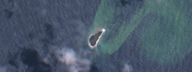
The island is about 400 m (1 312 feet) long and 100 m (328 feet) wide at the moment. The island was created about 120 m (390 feet) west of previous island which is now gone.
The new island is three times bigger than the previous one.
According to GNS Science volcanologist Brad Scott, eruptions from the same undersea volcano, which rose about 1 500 m (4 900 feet) from the sea depths, had produced other islands in the past.
However, most of those islands had been made of pumice and washed away.
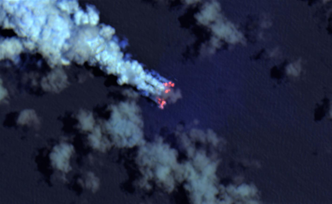
Remote sensing engineer Antonio Vecoli sends us Sentinel-2 imagery of the eruption and the new island:

Sentinel-2 L1C on October 10, 2019 – TC

Sentinel-2 L1C on October 15, 2019 – TC+SWIR
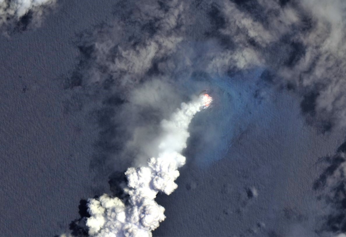
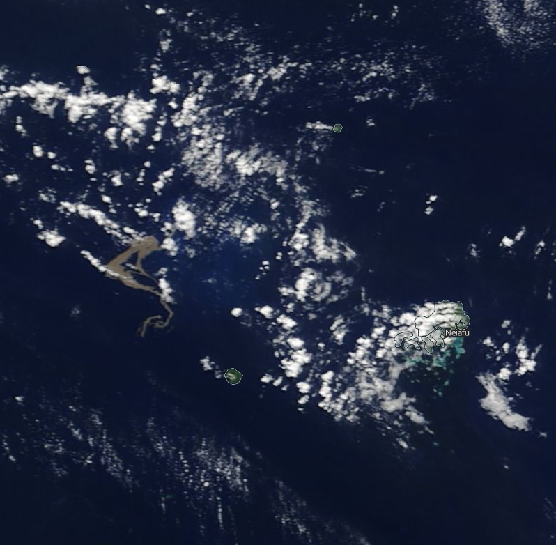
Sentinel-2 L1C on October 15, 2019 – wide, TC+SWIR
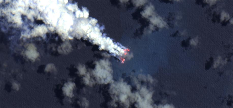
Sentinel-2 L1C on October 20, 2019

Sentinel-2 L1C on October 20, 2019 – wide, TC+SWIR
Sentinel-2 L1C on October 30, 2019 – zoomed, TC+SWIR
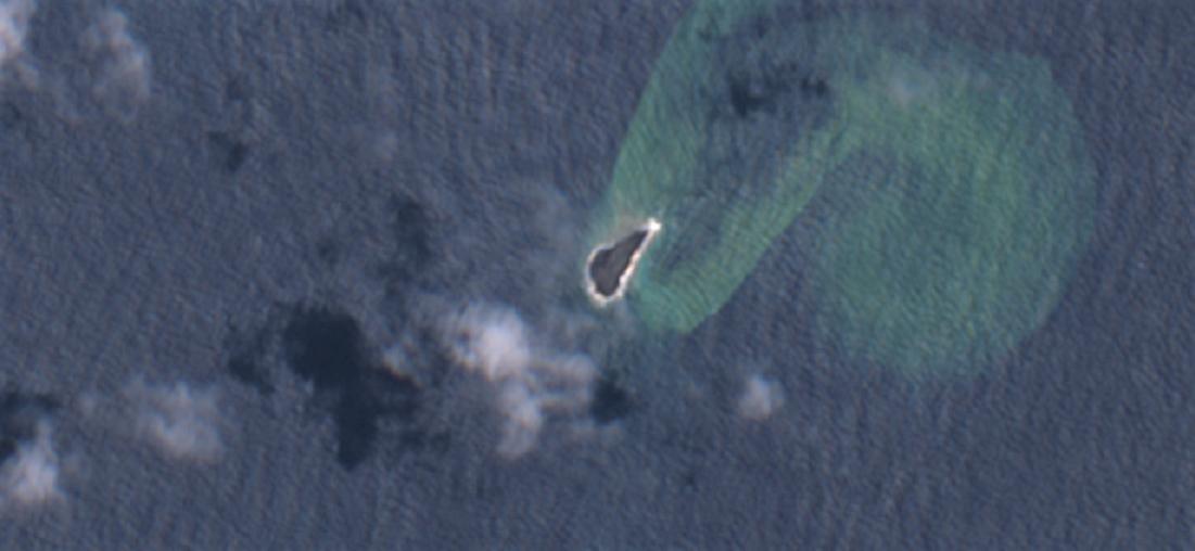
Sentinel-2 L1C on October 30, 2019 – TC

Sentinel-2 L1C on November 9, 2019 – TC
Satellite imagery credit: Antonio Vecoli
The Aviation Color Code for the volcano was raised to Orange at 21:20 UTC on October 14, 2019, after several observations confirmed eruption in progress.
Real Tonga pilots flying between Tongatapu and Vava'u observed the intermittent plumes rising to 4.6 – 5.2 km (15 000 – 17 000 feet) above sea level and drifting N on October 14. Ash in the plumes was not identifiable, according to the Wellington Volcanic Ash Advisory Centre (VAAC).
The volcano is the source of a massive amount of floating pumice detected in August 2019.
Pumice and discolored sea as observed by NASA Terra/MODIS on August 10, 2019
The last confirmed eruption of this volcano (VEI 2) started on June 6, 1995, and ended on June 23 (± 2 days).
Geological summary
Metis Shoal, a submarine volcano midway between the islands of Kao and Late, has produced a series of ephemeral islands since the first confirmed activity in the mid-19th century.
An island, perhaps not in eruption, was reported in 1781 and subsequently was eroded away.
During periods of inactivity following 20th century eruptions, waves have been observed to break on rocky reefs or sandy banks with depths of 10 m (33 feet) or less. Dacitic tuff cones formed during the first 20th century eruptions in 1967 and 1979 were soon eroded beneath the sea surface.
An eruption in 1995 produced an island with a diameter of 280 m (920 feet) and a height of 43 m (140 feet) following growth of a lava dome above the surface.
Featured image: Lateiki (Metis Shoal) as seen by ESA/Sentinel-2 on October 30, 2019. Credit: Antonio Vecoli
Commenting rules and guidelines
We value the thoughts and opinions of our readers and welcome healthy discussions on our website. In order to maintain a respectful and positive community, we ask that all commenters follow these rules:
We reserve the right to remove any comments that violate these rules. By commenting on our website, you agree to abide by these guidelines. Thank you for helping to create a positive and welcoming environment for all.